Ceilloux (Ceilloux)

- commune in Puy-de-Dôme, France
- Country:

- Postal Code: 63520
- Coordinates: 45° 39' 9" N, 3° 30' 53" E


- GPS tracks (wikiloc): [Link]
- Area: 8.99 sq km
- Population: 177
- Wikipedia en: wiki(en)
- Wikipedia: wiki(fr)
- Wikidata storage: Wikidata: Q1046715
- Wikipedia Commons Category: [Link]
- Freebase ID: [/m/03qh8hq]
- GeoNames ID: Alt: [6450333]
- SIREN number: [216300657]
- BnF ID: [15269415r]
- INSEE municipality code: 63065
Shares border with regions:
Domaize
- commune in Puy-de-Dôme, France
- Country:
- Postal Code: 63520
- Coordinates: 45° 41' 16" N, 3° 32' 10" E
- GPS tracks (wikiloc): [Link]
- Area: 14.6 sq km
- Population: 388


Saint-Dier-d'Auvergne
- commune in Puy-de-Dôme, France
- Country:
- Postal Code: 63520
- Coordinates: 45° 40' 33" N, 3° 28' 57" E
- GPS tracks (wikiloc): [Link]
- Area: 20.15 sq km
- Population: 514
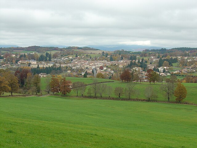
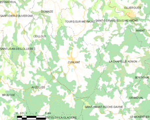
Cunlhat
- commune in Puy-de-Dôme, France
- Country:
- Postal Code: 63590
- Coordinates: 45° 37' 55" N, 3° 33' 33" E
- GPS tracks (wikiloc): [Link]
- Area: 29.55 sq km
- Population: 1248
- Web site: [Link]


Auzelles
- commune in Puy-de-Dôme, France
- Country:
- Postal Code: 63590
- Coordinates: 45° 36' 7" N, 3° 30' 34" E
- GPS tracks (wikiloc): [Link]
- Area: 33.42 sq km
- Population: 354