Champeaux (Champeaux)

- commune in Ille-et-Vilaine, France
- Country:

- Postal Code: 35500
- Coordinates: 48° 8' 50" N, 1° 18' 40" E


- GPS tracks (wikiloc): [Link]
- AboveSeaLevel: 86 м m
- Area: 9.83 sq km
- Population: 491
- Wikipedia en: wiki(en)
- Wikipedia: wiki(fr)
- Wikidata storage: Wikidata: Q383186
- Wikipedia Commons Gallery: [Link]
- Wikipedia Commons Category: [Link]
- Freebase ID: [/m/03mdyb0]
- Freebase ID: [/m/03mdyb0]
- GeoNames ID: Alt: [6448541]
- GeoNames ID: Alt: [6448541]
- SIREN number: [213500523]
- SIREN number: [213500523]
- BnF ID: [152569961]
- BnF ID: [152569961]
- OSM relation ID: [108434]
- OSM relation ID: [108434]
- INSEE municipality code: 35052
- INSEE municipality code: 35052
Shares border with regions:

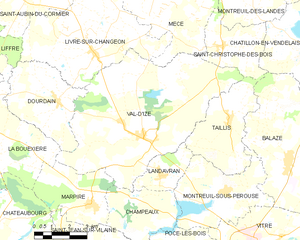
Val-d'Izé
- commune in Ille-et-Vilaine, France
- Country:
- Postal Code: 35450
- Coordinates: 48° 10' 38" N, 1° 18' 17" E
- GPS tracks (wikiloc): [Link]
- Area: 43.79 sq km
- Population: 2588
- Web site: [Link]

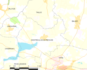
Montreuil-sous-Pérouse
- commune in Ille-et-Vilaine, France
- Country:
- Postal Code: 35500
- Coordinates: 48° 9' 3" N, 1° 14' 12" E
- GPS tracks (wikiloc): [Link]
- AboveSeaLevel: 64 м m
- Area: 15.49 sq km
- Population: 1023
- Web site: [Link]


Marpiré
- commune in Ille-et-Vilaine, France
- Country:
- Postal Code: 35220
- Coordinates: 48° 8' 35" N, 1° 20' 23" E
- GPS tracks (wikiloc): [Link]
- AboveSeaLevel: 110 м m
- Area: 10.62 sq km
- Population: 1075

Landavran
- commune in Ille-et-Vilaine, France
- Country:
- Postal Code: 35450
- Coordinates: 48° 9' 32" N, 1° 17' 22" E
- GPS tracks (wikiloc): [Link]
- AboveSeaLevel: 113 м m
- Area: 5.01 sq km
- Population: 688
- Web site: [Link]


Pocé-les-Bois
- commune in Ille-et-Vilaine, France
- Country:
- Postal Code: 35500
- Coordinates: 48° 6' 57" N, 1° 14' 59" E
- GPS tracks (wikiloc): [Link]
- AboveSeaLevel: 91 м m
- Area: 14.84 sq km
- Population: 1273


Saint-Jean-sur-Vilaine
- commune in Ille-et-Vilaine, France
- Country:
- Postal Code: 35220
- Coordinates: 48° 7' 1" N, 1° 21' 39" E
- GPS tracks (wikiloc): [Link]
- Area: 10.73 sq km
- Population: 1139
- Web site: [Link]