Charraix (Charraix)

- commune in Haute-Loire, France
- Country:

- Postal Code: 43300
- Coordinates: 45° 1' 34" N, 3° 34' 7" E


- GPS tracks (wikiloc): [Link]
- Area: 9.46 sq km
- Population: 83
- Wikipedia en: wiki(en)
- Wikipedia: wiki(fr)
- Wikidata storage: Wikidata: Q274607
- Wikipedia Commons Category: [Link]
- Freebase ID: [/m/03ntlz4]
- GeoNames ID: Alt: [6449038]
- SIREN number: [214300600]
- BnF ID: [15259965g]
- INSEE municipality code: 43060
Shares border with regions:
Cubelles
- commune in Haute-Loire, France
- Country:
- Postal Code: 43170
- Coordinates: 45° 0' 24" N, 3° 34' 44" E
- GPS tracks (wikiloc): [Link]
- Area: 12.13 sq km
- Population: 151


Pébrac
- commune in Haute-Loire, France
- Country:
- Postal Code: 43300
- Coordinates: 45° 1' 54" N, 3° 30' 34" E
- GPS tracks (wikiloc): [Link]
- Area: 17.85 sq km
- Population: 116


Venteuges
- commune in Haute-Loire, France
- Country:
- Postal Code: 43170
- Coordinates: 44° 59' 4" N, 3° 29' 51" E
- GPS tracks (wikiloc): [Link]
- Area: 39.35 sq km
- Population: 355
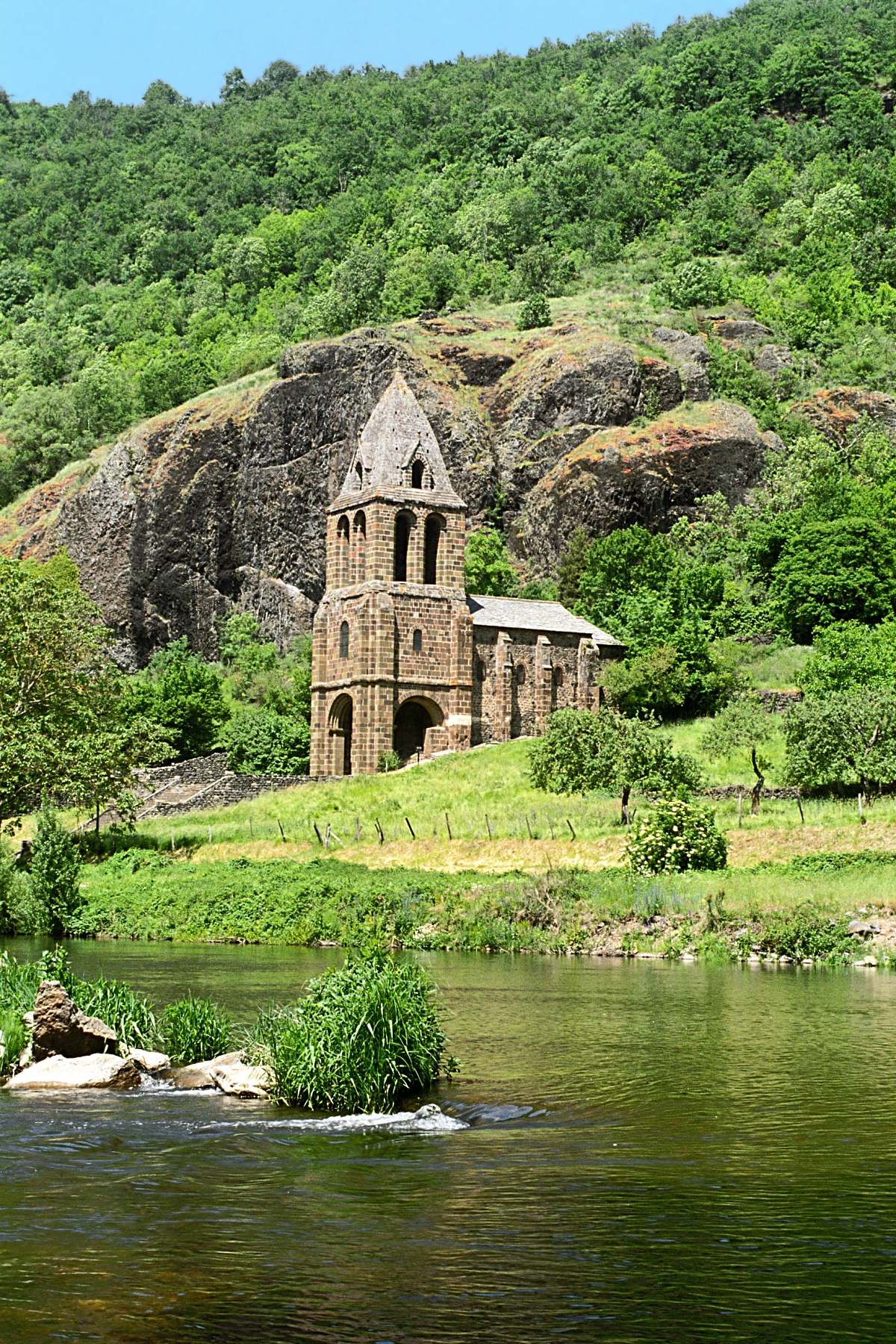
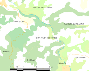
Saint-Julien-des-Chazes
- commune in Haute-Loire, France
- Country:
- Postal Code: 43300
- Coordinates: 45° 2' 48" N, 3° 35' 0" E
- GPS tracks (wikiloc): [Link]
- Area: 6.63 sq km
- Population: 68

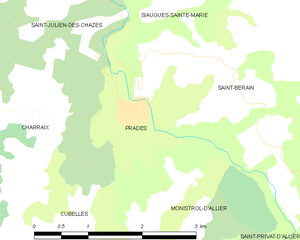
Prades
- commune in Haute-Loire, France
- Country:
- Postal Code: 43300
- Coordinates: 45° 1' 39" N, 3° 35' 34" E
- GPS tracks (wikiloc): [Link]
- AboveSeaLevel: 550 м m
- Area: 4.82 sq km
- Population: 66