Chauriat (Chauriat)

- commune in Puy-de-Dôme, France
- Country:

- Postal Code: 63117
- Coordinates: 45° 45' 5" N, 3° 16' 44" E


- GPS tracks (wikiloc): [Link]
- Area: 8.64 sq km
- Population: 1654
- Web site: http://www.chauriat.fr
- Wikipedia en: wiki(en)
- Wikipedia: wiki(fr)
- Wikidata storage: Wikidata: Q625008
- Wikipedia Commons Category: [Link]
- Freebase ID: [/m/03qh950]
- GeoNames ID: Alt: [6439995]
- SIREN number: [216301069]
- BnF ID: [15269456b]
- VIAF ID: Alt: [244314504]
- INSEE municipality code: 63106
Shares border with regions:

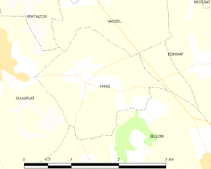
Chas
- commune in Puy-de-Dôme, France
- Country:
- Postal Code: 63160
- Coordinates: 45° 44' 56" N, 3° 18' 6" E
- GPS tracks (wikiloc): [Link]
- Area: 3.52 sq km
- Population: 376


Vertaizon
- commune in Puy-de-Dôme, France
- Country:
- Postal Code: 63910
- Coordinates: 45° 46' 11" N, 3° 17' 11" E
- GPS tracks (wikiloc): [Link]
- AboveSeaLevel: 370 м m
- Area: 12.83 sq km
- Population: 3280

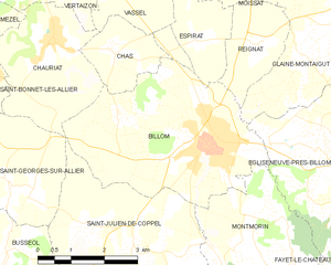
Billom
- commune in Puy-de-Dôme, France
- Country:
- Postal Code: 63160
- Coordinates: 45° 43' 22" N, 3° 20' 19" E
- GPS tracks (wikiloc): [Link]
- Area: 16.96 sq km
- Population: 4745
- Web site: [Link]
Saint-Georges-sur-Allier
- commune in Puy-de-Dôme, France
- Country:
- Postal Code: 63800
- Coordinates: 45° 42' 37" N, 3° 14' 33" E
- GPS tracks (wikiloc): [Link]
- Area: 9.42 sq km
- Population: 1238
- Web site: [Link]


Mezel
- commune in Puy-de-Dôme, France
- Country:
- Postal Code: 63115
- Coordinates: 45° 45' 18" N, 3° 14' 32" E
- GPS tracks (wikiloc): [Link]
- Area: 8.4 sq km
- Population: 1916
Vassel
- commune in Puy-de-Dôme, France
- Country:
- Postal Code: 63910
- Coordinates: 45° 45' 54" N, 3° 18' 36" E
- GPS tracks (wikiloc): [Link]
- Area: 2.95 sq km
- Population: 282
Saint-Bonnet-lès-Allier
- commune in Puy-de-Dôme, France
- Country:
- Postal Code: 63800
- Coordinates: 45° 44' 30" N, 3° 15' 14" E
- GPS tracks (wikiloc): [Link]
- Area: 1.51 sq km
- Population: 435