Clam (Clam)

- commune in Charente-Maritime, France
- Country:

- Postal Code: 17500
- Coordinates: 45° 29' 38" N, 0° 26' 55" E


- GPS tracks (wikiloc): [Link]
- Area: 6.83 sq km
- Population: 420
- Wikipedia en: wiki(en)
- Wikipedia: wiki(fr)
- Wikidata storage: Wikidata: Q1078685
- Wikipedia Commons Category: [Link]
- Freebase ID: [/m/03mcgnh]
- GeoNames ID: Alt: [6427919]
- SIREN number: [211701081]
- BnF ID: [15248970m]
- INSEE municipality code: 17108
Shares border with regions:

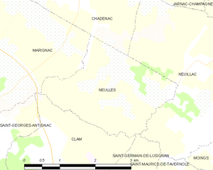
Neulles
- commune in Charente-Maritime, France
- Country:
- Postal Code: 17500
- Coordinates: 45° 30' 10" N, 0° 25' 3" E
- GPS tracks (wikiloc): [Link]
- Area: 5.9 sq km
- Population: 151


Marignac
- commune in Charente-Maritime, France
- Country:
- Postal Code: 17800
- Coordinates: 45° 31' 18" N, 0° 28' 34" E
- GPS tracks (wikiloc): [Link]
- Area: 13.5 sq km
- Population: 419


Saint-Germain-de-Lusignan
- commune in Charente-Maritime, France
- Country:
- Postal Code: 17500
- Coordinates: 45° 26' 59" N, 0° 27' 39" E
- GPS tracks (wikiloc): [Link]
- Area: 18.05 sq km
- Population: 1280
- Web site: [Link]

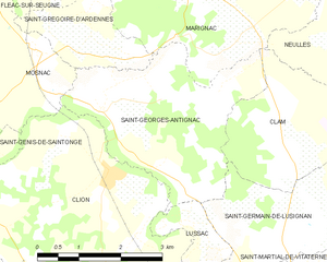
Saint-Georges-Antignac
- commune in Charente-Maritime, France
- Country:
- Postal Code: 17240
- Coordinates: 45° 29' 37" N, 0° 30' 14" E
- GPS tracks (wikiloc): [Link]
- Area: 10.1 sq km
- Population: 380