Coëx (Coëx)

- commune in Vendée, France
- Country:

- Postal Code: 85220
- Coordinates: 46° 41' 51" N, 1° 45' 38" E


- GPS tracks (wikiloc): [Link]
- Area: 39.56 sq km
- Population: 3134
- Web site: http://www.ville-coex.fr
- Wikipedia en: wiki(en)
- Wikipedia: wiki(fr)
- Wikidata storage: Wikidata: Q1107916
- Wikipedia Commons Category: [Link]
- Freebase ID: [/m/03qhlxr]
- GeoNames ID: Alt: [3024447]
- SIREN number: [218500700]
- BnF ID: [15278198d]
- VIAF ID: Alt: [164858519]
- WOEID: [586386]
- INSEE municipality code: 85070
Shares border with regions:


L'Aiguillon-sur-Vie
- commune in Vendée, France
- Country:
- Postal Code: 85220
- Coordinates: 46° 40' 12" N, 1° 49' 44" E
- GPS tracks (wikiloc): [Link]
- Area: 23.22 sq km
- Population: 1918
- Web site: [Link]


Commequiers
- commune in Vendée, France
- Country:
- Postal Code: 85220
- Coordinates: 46° 45' 46" N, 1° 50' 14" E
- GPS tracks (wikiloc): [Link]
- Area: 40.26 sq km
- Population: 3407
- Web site: [Link]


La Chapelle-Hermier
- commune in Vendée, France
- Country:
- Postal Code: 85220
- Coordinates: 46° 41' 1" N, 1° 43' 13" E
- GPS tracks (wikiloc): [Link]
- AboveSeaLevel: 58 м m
- Area: 17.94 sq km
- Population: 909


Saint-Révérend
- commune in Vendée, France
- Country:
- Postal Code: 85220
- Coordinates: 46° 41' 56" N, 1° 49' 45" E
- GPS tracks (wikiloc): [Link]
- Area: 15.82 sq km
- Population: 1423
- Web site: [Link]

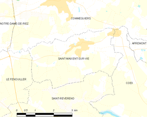
Saint-Maixent-sur-Vie
- commune in Vendée, France
- Country:
- Postal Code: 85220
- Coordinates: 46° 44' 25" N, 1° 49' 16" E
- GPS tracks (wikiloc): [Link]
- Area: 10.71 sq km
- Population: 1036
- Web site: [Link]


Aizenay
- commune in Vendée, France
- Country:
- Postal Code: 85190
- Coordinates: 46° 44' 24" N, 1° 36' 30" E
- GPS tracks (wikiloc): [Link]
- Area: 81.06 sq km
- Population: 9212
- Web site: [Link]


Apremont
- commune in Vendée, France
- Country:
- Postal Code: 85220
- Coordinates: 46° 45' 0" N, 1° 44' 27" E
- GPS tracks (wikiloc): [Link]
- Area: 29.73 sq km
- Population: 1784
- Web site: [Link]