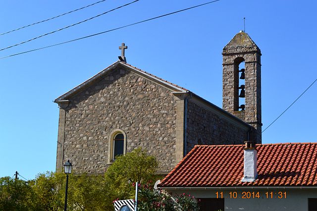
Coggia (Coggia)

- commune in Corse-du-Sud, France
- Country:

- Postal Code: 20160
- Coordinates: 42° 7' 23" N, 8° 44' 56" E


- GPS tracks (wikiloc): [Link]
- AboveSeaLevel: 400 м m
- Area: 31.33 sq km
- Population: 744
- Wikipedia en: wiki(en)
- Wikipedia: wiki(fr)
- Wikidata storage: Wikidata: Q246444
- Wikipedia Commons Category: [Link]
- Freebase ID: [/m/03mfg0d]
- GeoNames ID: Alt: [6448127]
- SIREN number: [212000905]
- BnF ID: [152499580]
- INSEE municipality code: 2A090
Shares border with regions:


Arbori
- commune in Corse-du-Sud, France
- Country:
- Postal Code: 20160
- Coordinates: 42° 8' 30" N, 8° 47' 49" E
- GPS tracks (wikiloc): [Link]
- AboveSeaLevel: 345 м m
- Area: 20.03 sq km
- Population: 55

Ambiegna
- commune in Corse-du-Sud, France
- Country:
- Postal Code: 20151
- Coordinates: 42° 5' 2" N, 8° 47' 33" E
- GPS tracks (wikiloc): [Link]
- AboveSeaLevel: 400 м m
- Area: 6.12 sq km
- Population: 68
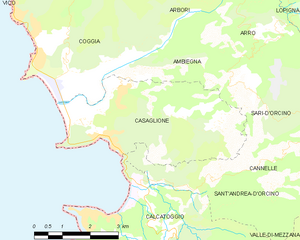
Casaglione
- commune in Corse-du-Sud, France
- Country:
- Postal Code: 20111
- Coordinates: 42° 4' 4" N, 8° 47' 17" E
- GPS tracks (wikiloc): [Link]
- AboveSeaLevel: 140 м m
- Area: 14.73 sq km
- Population: 380


Vico
- commune in Corse-du-Sud, France
- Country:
- Postal Code: 20160
- Coordinates: 42° 9' 59" N, 8° 47' 56" E
- GPS tracks (wikiloc): [Link]
- Area: 52.13 sq km
- Population: 907
- Web site: [Link]