Condé-sur-Ifs (Condé-sur-Ifs)

- commune in Calvados, France
- Country:

- Postal Code: 14270
- Coordinates: 49° 2' 34" N, 0° 7' 36" E


- GPS tracks (wikiloc): [Link]
- Area: 11.34 sq km
- Population: 481
- Wikipedia en: wiki(en)
- Wikipedia: wiki(fr)
- Wikidata storage: Wikidata: Q646548
- Wikipedia Commons Category: [Link]
- Freebase ID: [/m/02r14b]
- Freebase ID: [/m/02r14b]
- GeoNames ID: Alt: [6614336]
- GeoNames ID: Alt: [6614336]
- SIREN number: [211401732]
- SIREN number: [211401732]
- PACTOLS thesaurus ID: [pcrtbNEvIPjpJZ]
- PACTOLS thesaurus ID: [pcrtbNEvIPjpJZ]
- INSEE municipality code: 14173
- INSEE municipality code: 14173
Shares border with regions:


Maizières
- commune in Calvados, France
- Country:
- Postal Code: 14190
- Coordinates: 49° 0' 59" N, 0° 9' 30" E
- GPS tracks (wikiloc): [Link]
- Area: 7.15 sq km
- Population: 453


Magny-la-Campagne
- former commune in Calvados, France
- Country:
- Postal Code: 14270
- Coordinates: 49° 2' 59" N, 0° 6' 9" E
- GPS tracks (wikiloc): [Link]
- Area: 6.26 sq km
- Population: 531


Vendeuvre
- commune in Calvados, France
- Country:
- Postal Code: 14170
- Coordinates: 48° 59' 28" N, 0° 4' 31" E
- GPS tracks (wikiloc): [Link]
- Area: 26.31 sq km
- Population: 731


Ernes
- commune in Calvados, France
- Country:
- Postal Code: 14270
- Coordinates: 49° 1' 1" N, 0° 7' 24" E
- GPS tracks (wikiloc): [Link]
- Area: 8.9 sq km
- Population: 334


Le Bû-sur-Rouvres
- commune in Calvados, France
- Country:
- Postal Code: 14190
- Coordinates: 49° 2' 0" N, 0° 10' 48" E
- GPS tracks (wikiloc): [Link]
- Area: 2.83 sq km
- Population: 101


Fierville-Bray
- former commune in Calvados, France
- Country:
- Postal Code: 14190
- Coordinates: 49° 4' 11" N, 0° 10' 55" E
- GPS tracks (wikiloc): [Link]
- AboveSeaLevel: 50 м m
- Area: 12.66 sq km
- Population: 520

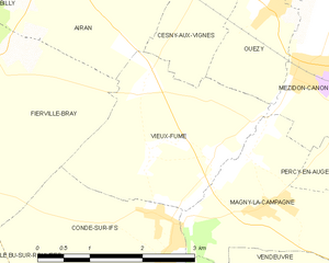
Vieux-Fumé
- former commune in Calvados, France
- Country:
- Postal Code: 14270
- Coordinates: 49° 3' 25" N, 0° 7' 2" E
- GPS tracks (wikiloc): [Link]
- Area: 6.69 sq km
- Population: 507