Courcy (Courcy)

- commune in Calvados, France
- Country:

- Postal Code: 14170
- Coordinates: 48° 58' 17" N, 0° 2' 36" E


- GPS tracks (wikiloc): [Link]
- Area: 9.12 sq km
- Population: 144
- Web site: http://www.mairiedecourcy.fr
- Wikipedia en: wiki(en)
- Wikipedia: wiki(fr)
- Wikidata storage: Wikidata: Q848529
- Wikipedia Commons Category: [Link]
- Freebase ID: [/m/02r1jx]
- Freebase ID: [/m/02r1jx]
- GeoNames ID: Alt: [6613459]
- GeoNames ID: Alt: [6613459]
- SIREN number: [211401906]
- SIREN number: [211401906]
- BnF ID: [15247604r]
- BnF ID: [15247604r]
- PACTOLS thesaurus ID: [pcrtucgPxniIE2]
- PACTOLS thesaurus ID: [pcrtucgPxniIE2]
- INSEE municipality code: 14190
- INSEE municipality code: 14190
Shares border with regions:


L'Oudon
- former commune in Calvados, France
- Country:
- Postal Code: 14170
- Coordinates: 48° 58' 4" N, 0° 4' 28" E
- GPS tracks (wikiloc): [Link]
- AboveSeaLevel: 80 м m
- Area: 54.84 sq km
- Population: 1574
- Web site: [Link]


Vendeuvre
- commune in Calvados, France
- Country:
- Postal Code: 14170
- Coordinates: 48° 59' 28" N, 0° 4' 31" E
- GPS tracks (wikiloc): [Link]
- Area: 26.31 sq km
- Population: 731

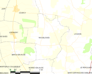
Vaudeloges
- former commune in Calvados, France
- Country:
- Postal Code: 14170
- Coordinates: 48° 56' 37" N, 0° 0' 20" E
- GPS tracks (wikiloc): [Link]
- AboveSeaLevel: 100 м m
- Area: 12.51 sq km
- Population: 208


Jort
- commune in Calvados, France
- Country:
- Postal Code: 14170
- Coordinates: 48° 58' 23" N, 0° 4' 46" E
- GPS tracks (wikiloc): [Link]
- Area: 6.58 sq km
- Population: 300


Louvagny
- commune in Calvados, France
- Country:
- Postal Code: 14170
- Coordinates: 48° 56' 47" N, 0° 2' 42" E
- GPS tracks (wikiloc): [Link]
- Area: 5.5 sq km
- Population: 62