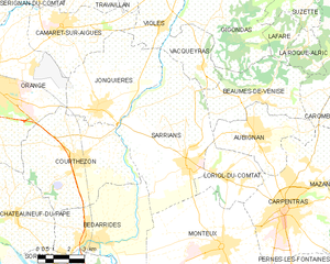
Courthézon (Courthézon)

- commune in Vaucluse, France
- Country:

- Postal Code: 84350
- Coordinates: 44° 5' 15" N, 4° 53' 3" E


- GPS tracks (wikiloc): [Link]
- Area: 32.78 sq km
- Population: 5476
- Web site: http://www.courthezon.fr
- Wikipedia en: wiki(en)
- Wikipedia: wiki(fr)
- Wikidata storage: Wikidata: Q377943
- Wikipedia Commons Category: [Link]
- Freebase ID: [/m/0c39t8]
- GeoNames ID: Alt: [3022897]
- SIREN number: [218400398]
- BnF ID: [152780190]
- VIAF ID: Alt: [143109351]
- Library of Congress authority ID: Alt: [n83205496]
- PACTOLS thesaurus ID: [pcrtfRKSsvXFJe]
- EMLO location ID: [3676d8f8-603a-4e98-9261-a7809fbc36e0]
- INSEE municipality code: 84039
Shares border with regions:


Orange
- commune in Vaucluse, France
- Country:
- Postal Code: 84100
- Coordinates: 44° 8' 15" N, 4° 48' 32" E
- GPS tracks (wikiloc): [Link]
- AboveSeaLevel: 50 м m
- Area: 74.2 sq km
- Population: 29561
- Web site: [Link]


Châteauneuf-du-Pape
- commune in Vaucluse, France
- Country:
- Postal Code: 84230
- Coordinates: 44° 3' 23" N, 4° 49' 54" E
- GPS tracks (wikiloc): [Link]
- Area: 25.85 sq km
- Population: 2225
- Web site: [Link]


Bédarrides
- commune in Vaucluse, France
- Country:
- Postal Code: 84370
- Coordinates: 44° 2' 26" N, 4° 53' 53" E
- GPS tracks (wikiloc): [Link]
- Area: 24.79 sq km
- Population: 5051
- Web site: [Link]

Sarrians
- commune in Vaucluse, France
 Hiking in Sarrians
Sarrians is a commune located in the Vaucluse department of the Provence-Alpes-Côte d'Azur region in southeastern France. Surrounded by the beauty of the Provençal countryside, Sarrians offers a variety of hiking opportunities that cater to different levels of experience and preferences....
- Country:
- Postal Code: 84260
- Coordinates: 44° 5' 0" N, 4° 58' 16" E
- GPS tracks (wikiloc): [Link]
- Area: 37.49 sq km
- Population: 5930
- Web site: [Link]


Jonquières
- commune in Vaucluse, France
- Country:
- Postal Code: 84150
- Coordinates: 44° 6' 55" N, 4° 53' 57" E
- GPS tracks (wikiloc): [Link]
- Area: 23.87 sq km
- Population: 5146
- Web site: [Link]