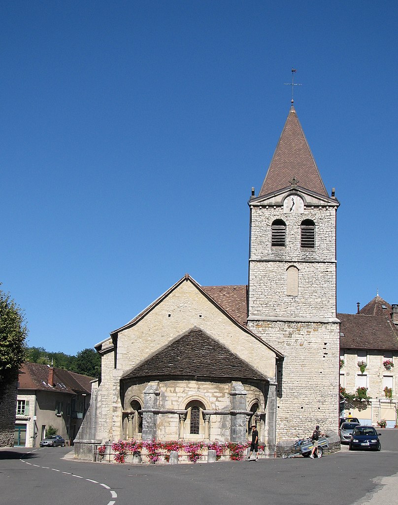
Creys-Mépieu (Creys-Mépieu)

- commune in Isère, France
 Hiking in Creys-Mépieu
Creys-Mépieu is a charming area located in the Auvergne-Rhône-Alpes region of France. While it may not be one of the most widely recognized hiking destinations, it offers some lovely outdoor experiences for those looking to explore its natural beauty.
Hiking Opportunities
-
Scenic Trails: The area features various trails that wind through picturesque landscapes, including forests and fields. These trails are suitable for different skill levels, making it accessible for both beginners and seasoned hikers.
-
Natural Surroundings: Hiking around Creys-Mépieu allows you to immerse yourself in the region's flora and fauna. You may encounter local wildlife and enjoy views of the surrounding countryside.
-
Nearby Parks: While the immediate area may have limited dedicated hiking trails, consider exploring nearby parks and natural reserves. The adjacent Isère River offers opportunities for walking and enjoying nature.
-
Cultural Sites: Incorporating some cultural exploration can enhance your hiking experience. Local historical sites or vineyards might be along your route, adding an educational twist to your outdoor adventure.
Tips for Hiking in Creys-Mépieu
- Check Local Maps: Before venturing out, ensure you have up-to-date maps or a GPS device. Wayfinding can sometimes be tricky in rural areas.
- Weather Preparedness: The weather can change quickly, so it's essential to dress in layers and carry rain gear.
- Stay Hydrated and Energized: Bring sufficient water and snacks to keep your energy levels up during your hikes.
- Respect Nature: Follow the “Leave No Trace” principles to preserve the natural beauty for future visitors.
Best Time to Hike
The best time to hike in the region is typically during the spring and fall when temperatures are milder, and the scenery is especially vibrant with blooming flowers or autumn foliage.
Overall, if you are in the Creys-Mépieu area, it offers a peaceful escape for hiking enthusiasts looking to enjoy the outdoors away from the hustle and bustle of more tourist-frequented paths.
- Country:

- Postal Code: 38510
- Coordinates: 45° 43' 42" N, 5° 29' 16" E


- GPS tracks (wikiloc): [Link]
- AboveSeaLevel: 260 м m
- Area: 28.99 sq km
- Population: 1543
- Web site: http://www.creys-mepieu.com
- Wikipedia en: wiki(en)
- Wikipedia: wiki(fr)
- Wikidata storage: Wikidata: Q1002693
- Wikipedia Commons Category: [Link]
- Freebase ID: [/m/03nvhnn]
- GeoNames ID: Alt: [6616656]
- SIREN number: [213801392]
- PACTOLS thesaurus ID: [pcrtYsiiUpeaMz]
- INSEE municipality code: 38139
Shares border with regions:


Courtenay
- commune in Isère, France
Hiking in Courtenay
Courtenay, located in the Isère department of France, is surrounded by beautiful mountainous landscapes, making it a great destination for hiking enthusiasts. Here are some highlights and considerations for hiking in the area:...
- Country:
- Postal Code: 38510
- Coordinates: 45° 43' 45" N, 5° 22' 45" E
- GPS tracks (wikiloc): [Link]
- Area: 32.08 sq km
- Population: 1276
- Web site: [Link]

Briord
- commune in Ain, France
Hiking in Briord
Briord is a charming commune located in the Ain department of the Auvergne-Rhône-Alpes region in southeastern France. It offers a mix of natural beauty and cultural heritage, making it an interesting destination for hikers and outdoor enthusiasts....
- Country:
- Postal Code: 01470
- Coordinates: 45° 46' 57" N, 5° 27' 34" E
- GPS tracks (wikiloc): [Link]
- Area: 12.29 sq km
- Population: 1000
- Web site: [Link]


Arandon
- former commune in Isère, France
Hiking in Arandon
Arandon is not widely recognized as a primary hiking destination, and information can vary depending on which specific region you mean, as there might be various places or trails with similar names. It's important to clarify or specify a particular area, as many locations around the world offer beautiful hiking opportunities under various names....
- Country:
- Postal Code: 38510
- Coordinates: 45° 42' 39" N, 5° 25' 45" E
- GPS tracks (wikiloc): [Link]
- Area: 12.22 sq km
- Population: 623
Lhuis
- commune in Ain, France
Hiking in Lhuis
Lhuis is a charming commune located in the Ain department of the Auvergne-Rhône-Alpes region of France. Nestled near the foothills of the Alps, it provides a beautiful backdrop for outdoor activities, including hiking. While Lhuis itself might be more quiet and less well-known than larger hiking destinations, it offers access to a range of trails that cater to different skill levels and preferences....
- Country:
- Postal Code: 01680
- Coordinates: 45° 44' 48" N, 5° 32' 0" E
- GPS tracks (wikiloc): [Link]
- Area: 24.43 sq km
- Population: 887
- Web site: [Link]


Bouvesse-Quirieu
- commune in Isère, France
Hiking in Bouvesse-Quirieu
Bouvesse-Quirieu is a small commune located in the Auvergne-Rhône-Alpes region of France, which offers a scenic backdrop for hiking enthusiasts. The area is characterized by its lush greenery, rolling hills, and diverse landscapes....
- Country:
- Postal Code: 38390
- Coordinates: 45° 47' 43" N, 5° 24' 53" E
- GPS tracks (wikiloc): [Link]
- Area: 17.51 sq km
- Population: 1504
- Web site: [Link]


Saint-Victor-de-Morestel
- commune in Isère, France
Hiking in Saint-Victor-de-Morestel
Saint-Victor-de-Morestel, located in the Auvergne-Rhône-Alpes region of France, is a charming commune that offers various opportunities for hiking and outdoor activities. The surrounding landscape is characterized by rolling hills, forests, and beautiful views of the Alps in the distance....
- Country:
- Postal Code: 38510
- Coordinates: 45° 41' 47" N, 5° 30' 12" E
- GPS tracks (wikiloc): [Link]
- Area: 13.13 sq km
- Population: 1101
- Web site: [Link]