Dampierre-sur-Boutonne (Dampierre-sur-Boutonne)

- commune in Charente-Maritime, France
- Country:

- Postal Code: 17470
- Coordinates: 46° 4' 2" N, 0° 24' 51" E


- GPS tracks (wikiloc): [Link]
- Area: 14.04 sq km
- Population: 276
- Web site: http://www.dampierre-sur-boutonne.fr
- Wikipedia en: wiki(en)
- Wikipedia: wiki(fr)
- Wikidata storage: Wikidata: Q624056
- Wikipedia Commons Category: [Link]
- Freebase ID: [/m/03mcg_h]
- GeoNames ID: Alt: [6427940]
- SIREN number: [211701388]
- BnF ID: [152490006]
- VIAF ID: Alt: [126718478]
- PACTOLS thesaurus ID: [pcrtY5a0U8GXS2]
- INSEE municipality code: 17138
Shares border with regions:


Blanzay-sur-Boutonne
- commune in Charente-Maritime, France
- Country:
- Postal Code: 17470
- Coordinates: 46° 3' 0" N, 0° 25' 46" E
- GPS tracks (wikiloc): [Link]
- Area: 5.75 sq km
- Population: 90
Le Vert
- commune in Deux-Sèvres, France
- Country:
- Postal Code: 79170
- Coordinates: 46° 5' 35" N, 0° 23' 43" E
- GPS tracks (wikiloc): [Link]
- Area: 11.81 sq km
- Population: 129
Chizé
- commune in Deux-Sèvres, France
- Country:
- Postal Code: 79170
- Coordinates: 46° 6' 56" N, 0° 20' 51" E
- GPS tracks (wikiloc): [Link]
- Area: 23.5 sq km
- Population: 872
- Web site: [Link]

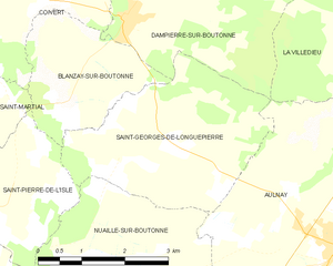
Saint-Georges-de-Longuepierre
- commune in Charente-Maritime, France
- Country:
- Postal Code: 17470
- Coordinates: 46° 2' 32" N, 0° 23' 54" E
- GPS tracks (wikiloc): [Link]
- Area: 10.69 sq km
- Population: 242
- Web site: [Link]


Coivert
- commune in Charente-Maritime, France
- Country:
- Postal Code: 17330
- Coordinates: 46° 4' 11" N, 0° 27' 32" E
- GPS tracks (wikiloc): [Link]
- Area: 14.78 sq km
- Population: 219


Saint-Séverin-sur-Boutonne
- commune in Charente-Maritime, France
- Country:
- Postal Code: 17330
- Coordinates: 46° 4' 58" N, 0° 25' 18" E
- GPS tracks (wikiloc): [Link]
- Area: 7.78 sq km
- Population: 104
- Web site: [Link]


La Villedieu
- commune in Charente-Maritime, France
- Country:
- Postal Code: 17470
- Coordinates: 46° 3' 41" N, 0° 19' 16" E
- GPS tracks (wikiloc): [Link]
- Area: 22.27 sq km
- Population: 208

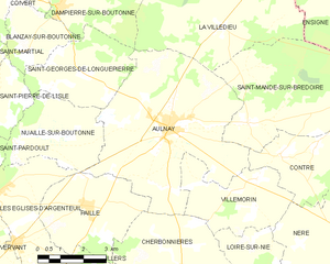
Aulnay
- commune in Charente-Maritime, France
- Country:
- Postal Code: 17470
- Coordinates: 46° 1' 15" N, 0° 20' 49" E
- GPS tracks (wikiloc): [Link]
- Area: 30.97 sq km
- Population: 1419
- Web site: [Link]