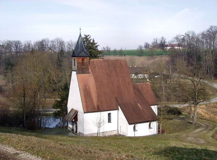
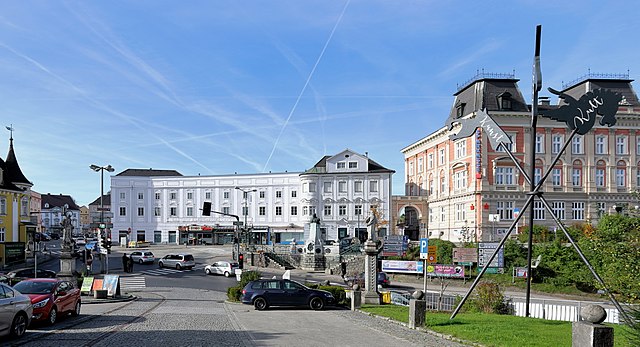
Edt bei Lambach (Edt bei Lambach)
- municipality in Austria
Edt bei Lambach is a picturesque village located in the Upper Austria region, surrounded by beautiful landscapes that offer excellent opportunities for hiking enthusiasts. The area features a combination of rolling hills, forests, and meandering rivers, making it ideal for both short and longer hikes.
Hiking Trails:
-
Local Nature Trails: There are several well-marked local trails that wind through the countryside, allowing hikers to enjoy the charming landscapes and observe local flora and fauna.
-
Hiking to the Traun River: Trails that lead you towards the Traun River offer scenic views and the chance to enjoy the tranquil waters. These walks can vary in length and difficulty, catering to all skill levels.
-
Nearby Mountain Trails: For more adventurous hikers, the foothills of the Alps are not far away. You can find more challenging trails that lead to higher altitudes and provide stunning panoramic views.
Tips for Hiking in Edt bei Lambach:
- Check Trail Conditions: Before heading out, check local resources or visitor centers for trail conditions, as they can change with weather conditions.
- Appropriate Gear: Ensure you have suitable hiking boots, weather-appropriate clothing, and plenty of water and snacks.
- Trail Maps: Use a trail map or a GPS device to stay oriented, especially if you're venturing into less-familiar areas.
- Local Flora and Fauna: Take the time to appreciate the local ecosystem. This region boasts a variety of plants and wildlife, so keep your eyes peeled for unique species.
Best Time to Hike:
The ideal time for hiking in Edt bei Lambach tends to be from spring to early autumn, when the weather is favorable, and the scenery is lush. However, winter hikes can also be rewarding with the right preparation for cold and snowy conditions.
Whether you’re looking for a leisurely stroll or a challenging hike, Edt bei Lambach has something to offer for everyone. Enjoy your outdoor adventures!
- Country:

- Postal Code: 4650
- Local Dialing Code: 0 72 45
- Licence Plate Code: WL
- Coordinates: 48° 5' 24" N, 13° 54' 17" E


- GPS tracks (wikiloc): [Link]
- AboveSeaLevel: 330 м m
- Area: 21 sq km
- Population: 2197
- Web site: http://www.edt.ooe.gv.at/
- Wikipedia en: wiki(en)
- Wikipedia: wiki(de)
- Wikidata storage: Wikidata: Q677339
- Wikipedia Commons Category: [Link]
- Freebase ID: [/m/03gvgx8]
- GeoNames ID: Alt: [7872183]
- Austrian municipality key: [41806]
Shares border with regions:

Pennewang
- municipality in Austria
Pennewang is a lesser-known hiking destination that offers a variety of trails suitable for different experience levels. While detailed information may vary, here's a general overview of what you might expect when hiking in this scenic area:...
- Country:

- Postal Code: 4624
- Local Dialing Code: 0 72 45
- Licence Plate Code: WL
- Coordinates: 48° 7' 46" N, 13° 50' 38" E


- GPS tracks (wikiloc): [Link]
- AboveSeaLevel: 396 м m
- Area: 18 sq km
- Population: 888
- Web site: [Link]


Fischlham
- municipality in Austria
Fischlham, located in Austria, is a charming area that offers several opportunities for hiking enthusiasts. The region is characterized by beautiful landscapes, rolling hills, and lush greenery, making it ideal for outdoor activities....
- Country:

- Postal Code: 4652
- Local Dialing Code: 0 72 41
- Licence Plate Code: WL
- Coordinates: 48° 5' 11" N, 13° 56' 55" E


- GPS tracks (wikiloc): [Link]
- AboveSeaLevel: 353 м m
- Area: 16 sq km
- Population: 1328
- Web site: [Link]

Bad Wimsbach-Neydharting
- municipality in Austria
 Hiking in Bad Wimsbach-Neydharting
Bad Wimsbach-Neydharting, located in the Upper Austria region, is a charming area that offers wonderful opportunities for hiking enthusiasts. The landscape here is characterized by rolling hills, dense forests, and scenic views, making it an ideal spot for both leisurely walks and more challenging hikes....
- Country:

- Postal Code: 4654
- Local Dialing Code: 07245
- Licence Plate Code: WL
- Coordinates: 48° 3' 50" N, 13° 54' 7" E


- GPS tracks (wikiloc): [Link]
- AboveSeaLevel: 387 м m
- Area: 24 sq km
- Population: 2533
- Web site: [Link]

Neukirchen bei Lambach
- municipality in Austria
 Hiking in Neukirchen bei Lambach
Neukirchen bei Lambach, located in Upper Austria, offers a variety of hiking opportunities for nature enthusiasts and outdoor lovers. Nestled among beautiful countryside and rolling hills, the region is known for its stunning landscapes and well-marked trails....
- Country:

- Postal Code: 4671
- Local Dialing Code: 07245
- Licence Plate Code: WL
- Coordinates: 48° 6' 3" N, 13° 49' 0" E


- GPS tracks (wikiloc): [Link]
- AboveSeaLevel: 401 м m
- Area: 12 sq km
- Population: 917

Lambach
- municipality in Austria
Lambach is a charming area located in Austria, known for its picturesque landscapes and serene hiking trails. The region offers a mix of elevation changes, lush forests, and beautiful views of the surrounding countryside. Here are some key points about hiking in Lambach:...
- Country:

- Postal Code: 4650
- Local Dialing Code: 07245
- Licence Plate Code: WL
- Coordinates: 48° 5' 40" N, 13° 52' 39" E


- GPS tracks (wikiloc): [Link]
- AboveSeaLevel: 367 м m
- Area: 4 sq km
- Population: 3435
- Web site: [Link]

Gunskirchen
- municipality in Austria
Gunskirchen, located in the Upper Austria region, is known for its picturesque landscapes and access to nature, making it a great spot for hiking enthusiasts. The area features a mix of rolling hills, forests, and scenic views that are characteristic of the Austrian countryside....
- Country:

- Postal Code: 4623
- Local Dialing Code: 07246
- Licence Plate Code: WL
- Coordinates: 48° 8' 4" N, 13° 56' 35" E


- GPS tracks (wikiloc): [Link]
- AboveSeaLevel: 352 м m
- Area: 36 sq km
- Population: 6037
- Web site: [Link]
Stadl-Paura
- municipality in Austria
Stadl-Paura, located in Upper Austria, offers a variety of hiking opportunities that cater to different skill levels and interests. Nestled in a picturesque setting with beautiful landscapes, the area is perfect for nature lovers and outdoor enthusiasts....
- Country:

- Postal Code: 4651
- Local Dialing Code: 07245
- Licence Plate Code: WL
- Coordinates: 48° 5' 2" N, 13° 51' 50" E


- GPS tracks (wikiloc): [Link]
- AboveSeaLevel: 360 м m
- Area: 15.05 sq km
- Population: 5053
- Web site: [Link]
