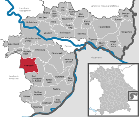
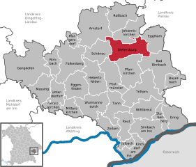
Egglham (Egglham)
- municipality of Germany
Egglham is a charming village located in Bavaria, Germany, and it's surrounded by beautiful landscapes, making it a lovely destination for hiking enthusiasts. Here are some key points to consider when hiking in and around Egglham:
Scenic Trails
-
Local Trails: There are various local trails that cater to hikers of different skill levels. Some trails offer easy walks suitable for families, while others present more challenging routes for seasoned hikers.
-
Nature Reserves: The area is rich in natural beauty, including forests, rivers, and hills. Look for paths that take you through local nature reserves, giving you a chance to observe unique flora and fauna.
-
Signposted Routes: Many trails are well-marked, with signposts indicating distances and levels of difficulty. It's advisable to carry a local hiking map or use a hiking app for navigation.
Attractions and Points of Interest
- Viewpoints: Some trails lead to viewpoints that provide stunning panoramas of the surrounding Bavarian countryside, making for a rewarding hiking experience.
- Cultural Sites: You may encounter historical and cultural sites along the way, such as churches, traditional Bavarian architecture, and old mills.
Best Times to Hike
- Spring and Fall: The best times for hiking in Egglham are during spring and autumn when the weather is mild and the scenery is particularly beautiful with blooming flowers or autumn foliage.
- Summer: This is also a pleasant time to hike, but it can be warmer, so be prepared with plenty of water and sun protection.
Tips
- Proper Footwear: Ensure you wear suitable hiking boots to navigate various terrains effectively.
- Local Regulations: Respect the local wildlife and environment by sticking to marked trails and following any local regulations regarding hiking.
- Safety Measures: Always let someone know your hiking plans and estimated return time, especially if you're going out on less populated trails.
Nearby Hiking Areas
If you're looking to explore beyond Egglham, consider hiking in nearby areas such as the Bayerischer Wald National Park, which offers an extensive network of trails and stunning natural scenery.
Egglham is an excellent base for experiencing the beauty of the Bavarian outdoors, so pack your gear, check local maps, and enjoy your hiking adventure!
- Country:

- Postal Code: 84385
- Local Dialing Code: 08543
- Licence Plate Code: PAN
- Coordinates: 48° 32' 0" N, 13° 4' 0" E


- GPS tracks (wikiloc): [Link]
- AboveSeaLevel: 353 м m
- Area: 36.84 sq km
- Population: 2298
- Web site: http://www.egglham.de/
- Wikipedia en: wiki(en)
- Wikipedia: wiki(de)
- Wikidata storage: Wikidata: Q529310
- Wikipedia Commons Category: [Link]
- Freebase ID: [/m/02q82w2]
- GeoNames ID: Alt: [2933029]
- VIAF ID: Alt: [240960830]
- OSM relation ID: [957069]
- GND ID: Alt: [4319787-5]
- MusicBrainz area ID: [99218bc5-e08a-494e-9ec9-4e77019af6fe]
- TGN ID: [7198427]
- Bavarikon ID: [ODB_A00009183]
- German municipality key: 09277117
Shares border with regions:


Aidenbach
- municipality of Germany
Aidenbach, located in Bavaria, Germany, is a charming area that offers a variety of beautiful hiking trails. The region is characterized by its rolling hills, lush forests, and picturesque landscapes, making it a delightful destination for both novice and experienced hikers....
- Country:

- Postal Code: 94501
- Local Dialing Code: 08543
- Licence Plate Code: PA
- Coordinates: 48° 34' 0" N, 13° 6' 0" E


- GPS tracks (wikiloc): [Link]
- AboveSeaLevel: 345 м m
- Area: 17.1 sq km
- Population: 2323
- Web site: [Link]

Haarbach
- municipality of Germany
Haarbach, located in Bavaria, Germany, is a lesser-known gem for those interested in hiking and nature exploration. While many people gravitate towards the popular hiking regions in the Alps or along more famous trails, Haarbach offers its own unique experiences. Here are a few highlights for hiking in and around Haarbach:...
- Country:

- Postal Code: 94542
- Local Dialing Code: 08535
- Licence Plate Code: PA
- Coordinates: 48° 30' 0" N, 13° 9' 0" E


- GPS tracks (wikiloc): [Link]
- AboveSeaLevel: 380 м m
- Area: 47.71 sq km
- Population: 2374
- Web site: [Link]

Beutelsbach
- municipality of Germany
Beutelsbach, located in the picturesque region of Baden-Württemberg, Germany, offers a variety of hiking opportunities that cater to different skill levels. The area is characterized by its rolling hills, vineyards, and scenic landscapes, making it a delightful destination for outdoor enthusiasts....
- Country:

- Postal Code: 94501
- Local Dialing Code: 08543
- Licence Plate Code: PA
- Coordinates: 48° 33' 0" N, 13° 7' 0" E


- GPS tracks (wikiloc): [Link]
- AboveSeaLevel: 357 м m
- Area: 20.39 sq km
- Population: 1082
- Web site: [Link]


Dietersburg
- municipality in Bavaria, Germany
Dietersburg, located in Bavaria, Germany, offers a variety of hiking opportunities for outdoor enthusiasts. While it may not be as well-known as some of the larger hiking destinations in Bavaria, it is surrounded by beautiful landscapes typical of the region, including rolling hills, forests, and picturesque countryside....
- Country:

- Postal Code: 84385; 84378
- Local Dialing Code: 08726; 08565; 08564; 08561
- Licence Plate Code: PAN
- Coordinates: 48° 30' 0" N, 12° 55' 0" E


- GPS tracks (wikiloc): [Link]
- AboveSeaLevel: 427 м m
- Area: 55.03 sq km
- Population: 3110
- Web site: [Link]

Bad Birnbach
- municipality in the district of Rottal-Inn in Bavaria
Bad Birnbach, located in the Lower Bavaria region of Germany, is known for its scenic landscapes, natural hot springs, and wellness facilities. The area is a great choice for hiking enthusiasts of all levels, offering a variety of trails that showcase the beautiful Bavarian countryside....
- Country:

- Postal Code: 84364
- Local Dialing Code: 08563
- Licence Plate Code: PAN
- Coordinates: 48° 27' 0" N, 13° 5' 0" E


- GPS tracks (wikiloc): [Link]
- AboveSeaLevel: 376 м m
- Area: 68.83 sq km
- Population: 5743
- Web site: [Link]

