Escalles (Escalles)

- commune in Pas-de-Calais, France
- Country:

- Postal Code: 62179
- Coordinates: 50° 55' 2" N, 1° 42' 50" E


- GPS tracks (wikiloc): [Link]
- Area: 7.29 sq km
- Population: 239
- Web site: http://www.escalles.fr
- Wikipedia en: wiki(en)
- Wikipedia: wiki(fr)
- Wikidata storage: Wikidata: Q1031980
- Wikipedia Commons Category: [Link]
- Freebase ID: [/m/02z3qc1]
- GeoNames ID: Alt: [6618404]
- SIREN number: [216203075]
- BnF ID: [15268749n]
- OSM relation ID: [185820]
- INSEE municipality code: 62307
Shares border with regions:


Hervelinghen
- commune in Pas-de-Calais, France
- Country:
- Postal Code: 62179
- Coordinates: 50° 52' 55" N, 1° 42' 42" E
- GPS tracks (wikiloc): [Link]
- Area: 5.89 sq km
- Population: 233
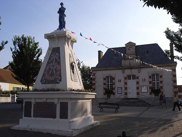

Wissant
- commune in Pas-de-Calais, France
- Country:
- Postal Code: 62179
- Coordinates: 50° 53' 7" N, 1° 39' 46" E
- GPS tracks (wikiloc): [Link]
- Area: 12.79 sq km
- Population: 988
- Web site: [Link]

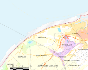
Sangatte
- commune in Pas-de-Calais, France
- Country:
- Postal Code: 62231
- Coordinates: 50° 56' 48" N, 1° 45' 24" E
- GPS tracks (wikiloc): [Link]
- Area: 14.28 sq km
- Population: 4766
- Web site: [Link]


Bonningues-lès-Calais
- commune in Pas-de-Calais, France
- Country:
- Postal Code: 62340
- Coordinates: 50° 53' 25" N, 1° 46' 29" E
- GPS tracks (wikiloc): [Link]
- Area: 8.49 sq km
- Population: 595
- Web site: [Link]


Peuplingues
- commune in Pas-de-Calais, France
- Country:
- Postal Code: 62231
- Coordinates: 50° 54' 54" N, 1° 46' 1" E
- GPS tracks (wikiloc): [Link]
- Area: 10.43 sq km
- Population: 777
- Web site: [Link]