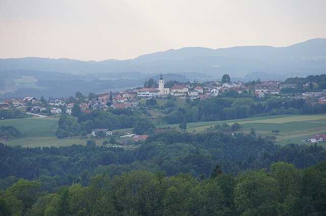
Eschenau im Hausruckkreis (Eschenau im Hausruckkreis)
- municipality in Austria
 Hiking in Eschenau im Hausruckkreis
Eschenau im Hausruckkreis is a charming village located in the Hausruckviertel region of Austria, surrounded by stunning natural landscapes that are perfect for hiking enthusiasts. Here are some highlights for hiking in this area:
Trails and Nature
-
Diverse Terrain: The region features a variety of terrains, including rolling hills, forests, and meadows, making it ideal for hikers of all skill levels.
-
Rundwanderwege (Circular Hiking Trails): There are several well-marked circular trails in and around Eschenau, allowing hikers to explore the area at their own pace.
-
Scenic Views: Many hikes provide breathtaking views of the surrounding countryside, especially in the autumn when foliage transforms into vibrant colors.
Points of Interest
-
Hausruckwald Nature Park: Nearby, this park offers extensive hiking routes along with opportunities to admire local flora and fauna.
-
Cultural Sights: While hiking, you may encounter local cultural landmarks such as traditional farmhouses or churches that add an interesting element to your adventure.
Tips for Hiking in Eschenau
-
Prepare Accordingly: Always check the weather forecast and prepare for changing conditions. Bring adequate gear, including sturdy footwear, a map, and plenty of water.
-
Trail Maps: Obtain local trail maps, which are often available at tourist information centers or online. These can provide valuable information on trail conditions and durations.
-
Respect Nature: Follow the Leave No Trace principles to help preserve the natural beauty of the area.
-
Local Guides: Consider joining guided hikes. Local guides can offer insights about the area's ecology and history while ensuring a safe experience.
Conclusion
Hiking in Eschenau im Hausruckkreis offers both the beauty of nature and a touch of local culture. Whether you prefer a leisurely stroll or a more challenging hike, the region has trails to suit every preference, making it a perfect destination for outdoor enthusiasts.
- Country:

- Postal Code: 4724
- Local Dialing Code: 07278
- Licence Plate Code: GR
- Coordinates: 48° 23' 20" N, 13° 49' 11" E


- GPS tracks (wikiloc): [Link]
- AboveSeaLevel: 380 м m
- Area: 16.61 sq km
- Population: 1063
- Web site: http://www.eschenau.ooe.gv.at/
- Wikipedia en: wiki(en)
- Wikipedia: wiki(de)
- Wikidata storage: Wikidata: Q681273
- Wikipedia Commons Category: [Link]
- Freebase ID: [/m/03gv4_5]
- GeoNames ID: Alt: [7873142]
- VIAF ID: Alt: [234849811]
- Austrian municipality key: [40804]
Shares border with regions:
Heiligenberg
- municipality in Austria
Heiligenberg, nestled in Austria, offers an array of picturesque hiking trails that cater to various skill levels. The region is characterized by its lush landscapes, rolling hills, and scenic views, making it a great destination for both novice hikers and experienced outdoors enthusiasts....
- Country:

- Postal Code: 4733
- Local Dialing Code: 07277
- Licence Plate Code: GR
- Coordinates: 48° 21' 18" N, 13° 49' 23" E


- GPS tracks (wikiloc): [Link]
- AboveSeaLevel: 398 м m
- Area: 13.86 sq km
- Population: 691
- Web site: [Link]

Neukirchen am Walde
- municipality in Austria
Neukirchen am Walde is a charming municipality located in Bavaria, Germany, nestled in the picturesque landscape of the Bavarian Forest. This region offers a variety of hiking opportunities for both beginners and seasoned hikers. Here are some highlights of hiking in Neukirchen am Walde:...
- Country:

- Postal Code: 4724
- Local Dialing Code: 07278
- Licence Plate Code: GR
- Coordinates: 48° 24' 21" N, 13° 46' 55" E


- GPS tracks (wikiloc): [Link]
- AboveSeaLevel: 555 м m
- Area: 15.8 sq km
- Population: 1633
- Web site: [Link]

Sankt Agatha
- municipality in Austria
Sankt Agatha, located in Austria, is a charming village that offers a range of hiking opportunities suitable for various skill levels. The surrounding landscape features picturesque valleys, rolling hills, and lush forests, making it a beautiful destination for nature enthusiasts....
- Country:

- Postal Code: 4084
- Local Dialing Code: 07277
- Licence Plate Code: GR
- Coordinates: 48° 23' 10" N, 13° 52' 44" E


- GPS tracks (wikiloc): [Link]
- AboveSeaLevel: 603 м m
- Area: 31.8 sq km
- Population: 2116
- Web site: [Link]


Waldkirchen am Wesen
- municipality in Austria
 Hiking in Waldkirchen am Wesen
Waldkirchen am Wesen is a charming village located in the beautiful region of Austria, specifically in the Upper Austria province. Nestled among the rolling hills and lush forests, it provides a fantastic backdrop for hikers of all levels. Here are some highlights and tips for hiking in this scenic area:...
- Country:

- Postal Code: 4085
- Local Dialing Code: 07718
- Licence Plate Code: SD
- Coordinates: 48° 27' 0" N, 13° 49' 0" E


- GPS tracks (wikiloc): [Link]
- AboveSeaLevel: 550 м m
- Area: 21.4 sq km
- Population: 1171
- Web site: [Link]
