Farges (Farges)
- commune in Ain, France
 Hiking in Farges
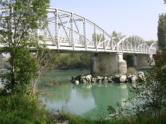
Farges, located in the Auvergne-Rhône-Alpes region of France, offers beautiful hiking opportunities for outdoor enthusiasts. The region is characterized by rolling hills, lush forests, and scenic landscapes, making it an excellent destination for both novice and experienced hikers.
Hiking Highlights in Farges
-
Scenic Trails: The area features various hiking trails that range in difficulty, allowing hikers to choose routes that suit their skill levels. You can expect diverse terrain, including gentle slopes and more challenging ascents.
-
Natural Beauty: Farges is surrounded by beautiful natural scenery, including rivers, mountains, and forests. Trails often lead through picturesque landscapes with opportunities to spot wildlife and enjoy panoramic views.
-
Local Flora and Fauna: The region is rich in biodiversity, and hikers can encounter a variety of plant species and possibly catch sight of local wildlife, including deer and various bird species.
-
Cultural Landmarks: Some trails may lead to historical and cultural landmarks, giving hikers a chance to explore local heritage along with nature.
-
All Seasons Hiking: Depending on the time of year, the hiking experience can vary significantly. Spring and summer offer lush greenery and wildflowers, while autumn provides stunning fall foliage, and winter can offer serene, snowy landscapes.
Tips for Hiking in Farges
-
Preparation: Always check the weather forecast before heading out, and dress in layers. Good hiking shoes are essential for navigating uneven terrain.
-
Stay Hydrated: Carry enough water, especially during warmer months, as trails can be long and demanding.
-
Local Guidance: Consider using local maps or hiring a guide, especially if you're unfamiliar with the area. This can enhance your experience and ensure safety.
-
Respect Nature: Follow the leave-no-trace principles to preserve the natural environment for future visitors.
Hiking in Farges can be a rewarding experience, offering a mix of adventure, tranquility, and connection to nature. Enjoy your hike!
- Country:

- Postal Code: 01550
- Coordinates: 46° 10' 4" N, 5° 54' 19" E


- GPS tracks (wikiloc): [Link]
- Area: 14.28 sq km
- Population: 999
- Web site: https://www.mairie-farges.fr
- Wikipedia en: wiki(en)
- Wikipedia: wiki(fr)
- Wikidata storage: Wikidata: Q457007
- Wikipedia Commons Category: [Link]
- Wikipedia Commons Maps Category: [Link]
- Freebase ID: [/m/03h1mkp]
- Freebase ID: [/m/03h1mkp]
- GeoNames ID: Alt: [6453500]
- GeoNames ID: Alt: [6453500]
- SIREN number: [210101580]
- SIREN number: [210101580]
- INSEE municipality code: 01158
- INSEE municipality code: 01158
Shares border with regions:

Collonges
- commune in Ain, France
Hiking in Collonges
Collonges, located in the Ain department of France, offers beautiful landscapes and a variety of hiking opportunities. The region is characterized by its diverse terrain, including rolling hills, forests, and rural countryside, making it ideal for both casual walkers and more experienced hikers....
- Country:
- Postal Code: 01550
- Coordinates: 46° 8' 19" N, 5° 54' 15" E
- GPS tracks (wikiloc): [Link]
- Area: 16.25 sq km
- Population: 2195
- Web site: [Link]
Pougny
- commune in Ain, France
Hiking in Pougny
Pougny is a small commune located in the Ain department in the Auvergne-Rhône-Alpes region of southeastern France. While not as widely known as some other hiking destinations in the region, it still offers opportunities for outdoor enthusiasts and hikers looking to explore the scenic countryside of the area....
- Country:
- Postal Code: 01550
- Coordinates: 46° 8' 23" N, 5° 56' 58" E
- GPS tracks (wikiloc): [Link]
- Area: 7.77 sq km
- Population: 817
- Web site: [Link]

Chézery-Forens
- commune in Ain, France
Hiking in Chézery-Forens
Chézery-Forens is a charming commune located in the Ain department in the Auvergne-Rhône-Alpes region of southeastern France. Known for its beautiful natural landscapes, it is a fantastic spot for hiking and exploring the great outdoors. Here are some key highlights about hiking in and around Chézery-Forens:...
- Country:
- Postal Code: 01200
- Coordinates: 46° 13' 18" N, 5° 51' 59" E
- GPS tracks (wikiloc): [Link]
- Area: 46.57 sq km
- Population: 460
- Web site: [Link]

Confort
- commune in Ain, France
Hiking in Confort
Confort is a charming village located in the Rhône-Alpes region of France, known for its picturesque landscapes and outdoor activities, including hiking. Here are some highlights and tips for hiking in and around Confort:...
- Country:
- Postal Code: 01200
- Coordinates: 46° 9' 0" N, 5° 49' 23" E
- GPS tracks (wikiloc): [Link]
- Area: 11.66 sq km
- Population: 591
- Web site: [Link]

Péron
- commune in Ain, France
Hiking in Péron
Péron, located in the Ain department of France near the Swiss border, offers stunning landscapes and a variety of hiking opportunities. Here are some key highlights for those looking to explore the hiking trails in and around Péron:...
- Country:
- Postal Code: 01630
- Coordinates: 46° 11' 24" N, 5° 55' 35" E
- GPS tracks (wikiloc): [Link]
- Area: 26.01 sq km
- Population: 2537
- Web site: [Link]