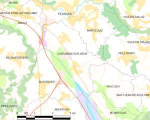
Faucigny (Faucigny)

- commune in Haute-Savoie, France
 Hiking in Faucigny
Faucigny is a beautiful region located in the Haute-Savoie department in the Auvergne-Rhône-Alpes region of southeastern France. The area is known for its stunning landscapes, characterized by the French Alps, lush valleys, and charming villages. Here are some highlights and tips for hiking in Faucigny:
Scenic Trails
- Mont Blanc Trails: While the classic Mont Blanc trek is a bit more to the east, the Faucigny area offers access to trails that provide spectacular views of Mont Blanc from various vantage points.
- Le Môle: This mountain is a popular hike that provides incredible panoramic views of the surrounding peaks and the Arve Valley. The trail is suitable for various skill levels and is especially popular during the summer months.
- La Roche de Solutré: An ideal spot for hiking enthusiasts, it offers a more challenging climb with impressive rewards at the summit.
Wildlife and Flora
The region is rich in biodiversity, with opportunities to spot local wildlife such as chamois, marmots, and various bird species. The flora varies from lush forests at lower elevations to alpine meadows bursting with wildflowers as you climb higher.
Accessibility
Faucigny is accessible from major cities like Geneva, making it an ideal day trip or weekend getaway for both local and international hikers. Many trailheads are reachable by public transportation or a short drive.
Seasons
- Summer: The best time for hiking with blooming wildflowers and clear trails. Make sure to stay hydrated and protect yourself from the sun.
- Autumn: The fall foliage provides beautiful scenery, but trails may be wet and slippery after rains.
- Winter: Some trails can be used for snowshoeing and winter hiking, but be sure to check the conditions and prepare for colder weather.
Preparation
- Equipment: Wear sturdy hiking boots and consider trekking poles for stability. Always pack a map or GPS device, plenty of water, snacks, and a first-aid kit.
- Weather: Alpine weather can be unpredictable, so check the forecast and be prepared for sudden changes.
- Local Regulations: Respect the environment by sticking to marked trails and following any local regulations regarding wildlife and vegetation.
Nearby Attractions
After a day of hiking, you can explore nearby villages like Bonneville and Cluses, which offer charming shops, restaurants, and local culture. They can be great for sampling local cuisine, such as Savoyard specialties like fondue or raclette.
In summary, hiking in Faucigny is a rewarding experience for both novice and experienced hikers. With stunning landscapes, diverse trails, and rich local culture, it’s a fantastic destination for outdoor enthusiasts!
- Country:

- Postal Code: 74130
- Coordinates: 46° 7' 7" N, 6° 21' 28" E


- GPS tracks (wikiloc): [Link]
- Area: 4.91 sq km
- Population: 593
- Wikipedia en: wiki(en)
- Wikipedia: wiki(fr)
- Wikidata storage: Wikidata: Q917751
- Wikipedia Commons Category: [Link]
- Freebase ID: [/m/01bxxl]
- GeoNames ID: Alt: [6454662]
- SIREN number: [217401223]
- BnF ID: [15274380x]
- INSEE municipality code: 74122
Shares border with regions:


Bonneville
- commune in Haute-Savoie, France
Hiking in Bonneville
Bonneville, located in the Haute-Savoie region of the French Alps, is a fantastic destination for hiking enthusiasts. The area is characterized by its stunning mountain scenery, lush valleys, and rich biodiversity. Here are some key details about hiking in and around Bonneville:...
- Country:
- Postal Code: 74130
- Coordinates: 46° 4' 44" N, 6° 24' 3" E
- GPS tracks (wikiloc): [Link]
- Area: 27.15 sq km
- Population: 12619
- Web site: [Link]

Contamine-sur-Arve
- commune in Haute-Savoie, France
Hiking in Contamine-sur-Arve
Contamine-sur-Arve is a charming commune located in the Haute-Savoie region of France, near Mont Blanc. It offers a variety of hiking opportunities that cater to different skill levels and preferences. Here are some highlights and tips for hiking in and around Contamine-sur-Arve:...
- Country:
- Postal Code: 74130
- Coordinates: 46° 7' 42" N, 6° 20' 26" E
- GPS tracks (wikiloc): [Link]
- Area: 6.92 sq km
- Population: 1940
- Web site: [Link]


Peillonnex
- commune in Haute-Savoie, France
Hiking in Peillonnex
Peillonnex, located in the Auvergne-Rhône-Alpes region of France, offers beautiful hiking opportunities with stunning views of the surrounding mountains and countryside. Here are some key points to consider when hiking in this area:...
- Country:
- Postal Code: 74250
- Coordinates: 46° 7' 53" N, 6° 22' 34" E
- GPS tracks (wikiloc): [Link]
- Area: 6.4 sq km
- Population: 1390
- Web site: [Link]


Saint-Jean-de-Tholome
- commune in Haute-Savoie, France
Hiking in Saint-Jean-de-Tholome
Saint-Jean-de-Tholome is a charming village located in the Haute-Savoie region of France, which is part of the Auvergne-Rhône-Alpes. This area is blessed with stunning natural landscapes that are perfect for hiking enthusiasts....
- Country:
- Postal Code: 74250
- Coordinates: 46° 6' 42" N, 6° 23' 52" E
- GPS tracks (wikiloc): [Link]
- Area: 12.37 sq km
- Population: 947