Fervaques (Fervaques)

- former commune in Calvados, France
- Country:

- Postal Code: 14140
- Coordinates: 49° 2' 28" N, 0° 15' 14" E


- GPS tracks (wikiloc): [Link]
- Area: 10.67 sq km
- Population: 685
- Wikipedia en: wiki(en)
- Wikipedia: wiki(fr)
- Wikidata storage: Wikidata: Q452697
- Wikipedia Commons Category: [Link]
- Freebase ID: [/m/02w_gg]
- Freebase ID: [/m/02w_gg]
- GeoNames ID: Alt: [6427218]
- GeoNames ID: Alt: [6427218]
- BnF ID: [15247679n]
- BnF ID: [15247679n]
- INSEE municipality code: 14265
- INSEE municipality code: 14265
Shares border with regions:


Cernay
- commune in Calvados, France
- Country:
- Postal Code: 14290
- Coordinates: 49° 1' 14" N, 0° 19' 27" E
- GPS tracks (wikiloc): [Link]
- Area: 5.82 sq km
- Population: 147


Tordouet
- former commune in Calvados, France
- Country:
- Postal Code: 14290
- Coordinates: 49° 2' 58" N, 0° 19' 48" E
- GPS tracks (wikiloc): [Link]
- Area: 6.76 sq km
- Population: 272

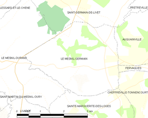
Le Mesnil-Germain
- former commune in Calvados, France
- Country:
- Postal Code: 14140
- Coordinates: 49° 2' 33" N, 0° 11' 25" E
- GPS tracks (wikiloc): [Link]
- Area: 8.67 sq km
- Population: 276

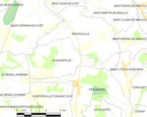
Auquainville
- former commune in Calvados, France
- Country:
- Postal Code: 14140
- Coordinates: 49° 3' 25" N, 0° 14' 21" E
- GPS tracks (wikiloc): [Link]
- Area: 9.56 sq km
- Population: 308

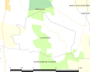
La Croupte
- former commune in Calvados, France
- Country:
- Postal Code: 14140
- Coordinates: 49° 1' 35" N, 0° 17' 6" E
- GPS tracks (wikiloc): [Link]
- Area: 3.45 sq km
- Population: 133


Notre-Dame-de-Courson
- former commune in Calvados, France
- Country:
- Postal Code: 14140
- Coordinates: 48° 59' 27" N, 0° 15' 44" E
- GPS tracks (wikiloc): [Link]
- Area: 19.4 sq km
- Population: 407


Saint-Cyr-du-Ronceray
- former commune in Calvados, France
- Country:
- Postal Code: 14290
- Coordinates: 49° 3' 11" N, 0° 17' 52" E
- GPS tracks (wikiloc): [Link]
- Area: 4.03 sq km
- Population: 718

Cheffreville-Tonnencourt
- former commune in Calvados, France
- Country:
- Postal Code: 14140
- Coordinates: 49° 1' 54" N, 0° 14' 33" E
- GPS tracks (wikiloc): [Link]
- Area: 7.72 sq km
- Population: 286