Fontaine-l'Abbé (Fontaine-l'Abbé)

- commune in Eure, France
- Country:

- Postal Code: 27470
- Coordinates: 49° 5' 28" N, 0° 41' 35" E


- GPS tracks (wikiloc): [Link]
- Area: 13.23 sq km
- Population: 528
- Web site: http://www.fontaine-labbe.fr/
- Wikipedia en: wiki(en)
- Wikipedia: wiki(fr)
- Wikidata storage: Wikidata: Q1074376
- Wikipedia Commons Category: [Link]
- Freebase ID: [/m/03nqh_n]
- Freebase ID: [/m/03nqh_n]
- GeoNames ID: Alt: [6430385]
- GeoNames ID: Alt: [6430385]
- SIREN number: [212702518]
- SIREN number: [212702518]
- BnF ID: [15253489n]
- BnF ID: [15253489n]
- INSEE municipality code: 27251
- INSEE municipality code: 27251
Shares border with regions:
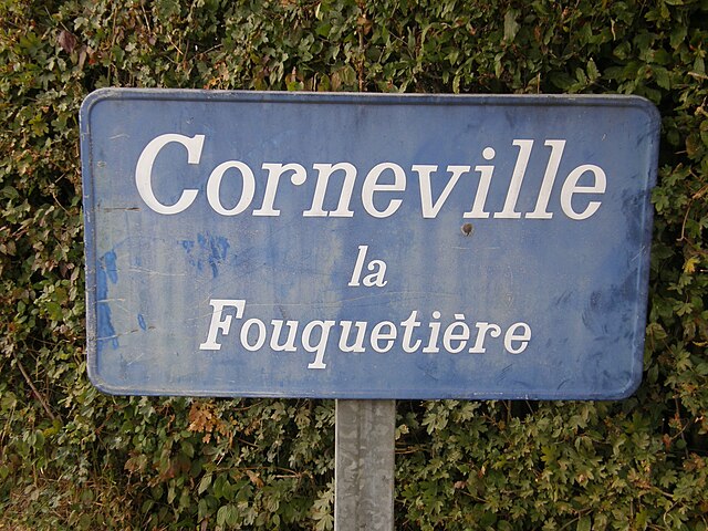
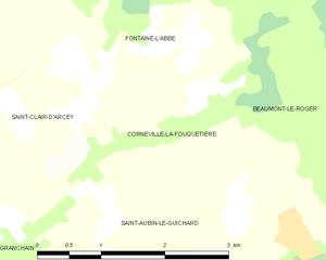
Corneville-la-Fouquetière
- commune in Eure, France
- Country:
- Postal Code: 27300
- Coordinates: 49° 3' 57" N, 0° 42' 19" E
- GPS tracks (wikiloc): [Link]
- Area: 3.99 sq km
- Population: 122


Saint-Léger-de-Rôtes
- commune in Eure, France
- Country:
- Postal Code: 27300
- Coordinates: 49° 6' 44" N, 0° 39' 36" E
- GPS tracks (wikiloc): [Link]
- Area: 6.46 sq km
- Population: 399
- Web site: [Link]


Bernay
- commune in Eure, France
- Country:
- Postal Code: 27300
- Coordinates: 49° 5' 19" N, 0° 35' 54" E
- GPS tracks (wikiloc): [Link]
- AboveSeaLevel: 108 м m
- Area: 24.03 sq km
- Population: 10432
- Web site: [Link]


Beaumont-le-Roger
- commune in Eure, France
- Country:
- Postal Code: 27170
- Coordinates: 49° 4' 48" N, 0° 46' 38" E
- GPS tracks (wikiloc): [Link]
- Area: 36.42 sq km
- Population: 3012
- Web site: [Link]

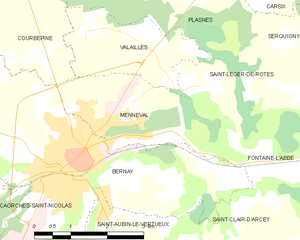
Menneval
- commune in Eure, France
- Country:
- Postal Code: 27300
- Coordinates: 49° 5' 50" N, 0° 37' 26" E
- GPS tracks (wikiloc): [Link]
- Area: 6.63 sq km
- Population: 1372