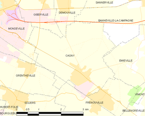
Frénouville (Frénouville)

- commune in Calvados, France
- Country:

- Postal Code: 14630
- Coordinates: 49° 8' 13" N, 0° 14' 39" E


- GPS tracks (wikiloc): [Link]
- AboveSeaLevel: 15 м m
- Area: 6.45 sq km
- Population: 1979
- Web site: http://www.frenouville.fr
- Wikipedia en: wiki(en)
- Wikipedia: wiki(fr)
- Wikidata storage: Wikidata: Q1013635
- Wikipedia Commons Category: [Link]
- Freebase ID: [/m/02yfl0]
- Freebase ID: [/m/02yfl0]
- GeoNames ID: Alt: [6615900]
- GeoNames ID: Alt: [6615900]
- SIREN number: [211402870]
- SIREN number: [211402870]
- BnF ID: [152477010]
- BnF ID: [152477010]
- VIAF ID: Alt: [247721971]
- VIAF ID: Alt: [247721971]
- PACTOLS thesaurus ID: [pcrt0wJ2qHwGOu]
- PACTOLS thesaurus ID: [pcrt0wJ2qHwGOu]
- INSEE municipality code: 14287
- INSEE municipality code: 14287
Shares border with regions:

Cagny
- commune in Calvados, France
- Country:
- Postal Code: 14630
- Coordinates: 49° 8' 43" N, 0° 15' 29" E
- GPS tracks (wikiloc): [Link]
- Area: 8.46 sq km
- Population: 1718
- Web site: [Link]


Bellengreville
- commune in Calvados, France
- Country:
- Postal Code: 14370
- Coordinates: 49° 7' 29" N, 0° 12' 41" E
- GPS tracks (wikiloc): [Link]
- Area: 10.15 sq km
- Population: 1520


Soliers
- commune in Calvados, France
- Country:
- Postal Code: 14540
- Coordinates: 49° 8' 5" N, 0° 17' 43" E
- GPS tracks (wikiloc): [Link]
- Area: 5.08 sq km
- Population: 2119
- Web site: [Link]


Émiéville
- commune in Calvados, France
- Country:
- Postal Code: 14630
- Coordinates: 49° 9' 5" N, 0° 13' 26" E
- GPS tracks (wikiloc): [Link]
- Area: 3.92 sq km
- Population: 582


Bourguébus
- commune in Calvados, France
- Country:
- Postal Code: 14540
- Coordinates: 49° 7' 17" N, 0° 17' 52" E
- GPS tracks (wikiloc): [Link]
- Area: 5.52 sq km
- Population: 1843


Vimont
- commune in Calvados, France
- Country:
- Postal Code: 14370
- Coordinates: 49° 7' 17" N, 0° 11' 55" E
- GPS tracks (wikiloc): [Link]
- Area: 8.96 sq km
- Population: 729


Grentheville
- commune in Calvados, France
- Country:
- Postal Code: 14540
- Coordinates: 49° 8' 55" N, 0° 17' 13" E
- GPS tracks (wikiloc): [Link]
- Area: 4.08 sq km
- Population: 874