Franchesse (Franchesse)
- commune in Allier, France
- Country:

- Postal Code: 03160
- Coordinates: 46° 38' 12" N, 3° 2' 12" E


- GPS tracks (wikiloc): [Link]
- Area: 40.24 sq km
- Population: 463
- Wikipedia en: wiki(en)
- Wikipedia: wiki(fr)
- Wikidata storage: Wikidata: Q845302
- Wikipedia Commons Category: [Link]
- Freebase ID: [/m/03m7sv0]
- Freebase ID: [/m/03m7sv0]
- GeoNames ID: Alt: [6425357]
- GeoNames ID: Alt: [6425357]
- SIREN number: [210301172]
- SIREN number: [210301172]
- INSEE municipality code: 03117
- INSEE municipality code: 03117
Shares border with regions:
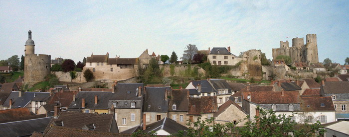
Bourbon-l'Archambault
- commune in Allier, France
- Country:
- Postal Code: 03160
- Coordinates: 46° 35' 0" N, 3° 3' 24" E
- GPS tracks (wikiloc): [Link]
- Area: 54.84 sq km
- Population: 2556
- Web site: [Link]

Couzon
- commune in Allier, France
- Country:
- Postal Code: 03160
- Coordinates: 46° 39' 29" N, 3° 7' 15" E
- GPS tracks (wikiloc): [Link]
- Area: 19.85 sq km
- Population: 284
Pouzy-Mésangy
- commune in Allier, France
- Country:
- Postal Code: 03320
- Coordinates: 46° 42' 31" N, 3° 0' 15" E
- GPS tracks (wikiloc): [Link]
- Area: 35.04 sq km
- Population: 399
- Web site: [Link]

Agonges
- commune in Allier, France
- Country:
- Postal Code: 03210
- Coordinates: 46° 36' 22" N, 3° 9' 31" E
- GPS tracks (wikiloc): [Link]
- Area: 24.1 sq km
- Population: 315
- Web site: [Link]

Saint-Léopardin-d'Augy
- commune in Allier, France
- Country:
- Postal Code: 03160
- Coordinates: 46° 40' 59" N, 3° 6' 14" E
- GPS tracks (wikiloc): [Link]
- Area: 39.59 sq km
- Population: 343
Limoise
- commune in Allier, France
- Country:
- Postal Code: 03320
- Coordinates: 46° 40' 35" N, 3° 3' 7" E
- GPS tracks (wikiloc): [Link]
- Area: 12.56 sq km
- Population: 163

Saint-Plaisir
- commune in Allier, France
- Country:
- Postal Code: 03160
- Coordinates: 46° 37' 21" N, 2° 58' 4" E
- GPS tracks (wikiloc): [Link]
- Area: 52.54 sq km
- Population: 388