Gaaden (Gaaden)
- municipality in Austria
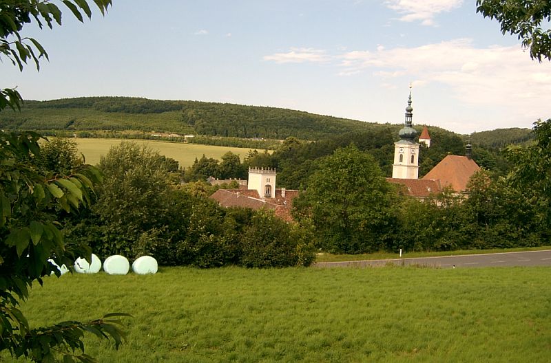
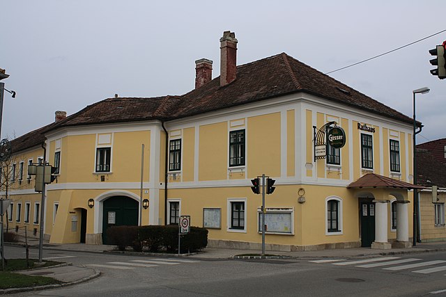
Gaaden is a small village located in Austria, near the scenic region of the Wienerwald (Vienna Woods). While it may not be as widely known as larger hiking destinations, it offers several opportunities for outdoor enthusiasts looking for scenic trails and a peaceful environment.
Hiking Trails
-
Surrounding Forest Trails: The Wienerwald is renowned for its extensive network of hiking trails. You can explore various routes that take you through dense forests, rolling hills, and picturesque landscapes.
-
Local Walking Paths: In and around Gaaden, there are often well-marked walking paths that can lead you to nearby attractions and beautiful viewpoints.
-
Historical Trails: Some trails may offer a glimpse into the history of the region, including old farms, vineyards, and historical landmarks.
Tips for Hiking in Gaaden
- Weather Check: Always check the weather conditions before heading out, as the weather can change quickly, especially in mountainous areas.
- Trail Maps: Having a map or a GPS app can be helpful, as some trails may not be as well-marked as in more popular hiking areas.
- Equipment: Wear appropriate hiking gear, including sturdy footwear and comfortable clothing suited for the season.
- Hydration and Snacks: Carry enough water and snacks, especially for longer hikes, as facilities may not be readily available.
Nearby Attractions
- Hiking to local wineries: The region is known for its wine production, and some hiking routes can lead you to vineyards where you can enjoy wine tasting.
- Cultural Sites: Depending on the trail, you may encounter historical sites and local cultural attractions.
Conclusion
Hiking in Gaaden offers a chance to enjoy the tranquility of nature while exploring the beautiful landscapes of the Wienerwald. Whether you’re looking for a leisurely walk or a more challenging hike, Gaaden’s surroundings provide a wonderful experience for hikers of all levels. Enjoy your hike!
- Country:

- Postal Code: 2531
- Local Dialing Code: 02237
- Licence Plate Code: MD
- Coordinates: 48° 3' 0" N, 16° 12' 0" E


- GPS tracks (wikiloc): [Link]
- AboveSeaLevel: 323 м m
- Area: 24.78 sq km
- Population: 1624
- Web site: http://www.gaaden.at/
- Wikipedia en: wiki(en)
- Wikipedia: wiki(de)
- Wikidata storage: Wikidata: Q669960
- Wikipedia Commons Category: [Link]
- Freebase ID: [/m/02qywsv]
- GeoNames ID: Alt: [2779074]
- VIAF ID: Alt: [238762640]
- archINFORM location ID: [14937]
- Quora topic ID: [Gaden]
- Austrian municipality key: [31706]
Shares border with regions:

Mödling
- city/municipality in Austria
Mödling, located just south of Vienna, Austria, is known for its beautiful landscapes and scenic hiking trails. The area is characterized by a mix of forested hills, vineyards, and historical landmarks, making it a great destination for both casual and experienced hikers....
- Country:

- Local Dialing Code: 02236
- Licence Plate Code: MD
- Coordinates: 48° 5' 8" N, 16° 16' 59" E


- GPS tracks (wikiloc): [Link]
- AboveSeaLevel: 246 м m
- Area: 9950000 sq km
- Population: 20555
- Web site: [Link]


Gumpoldskirchen
- municipality in Austria
Gumpoldskirchen, located just south of Vienna in Austria, is a charming village known for its beautiful vineyards, rolling hills, and scenic hiking trails. The area offers a wonderful blend of natural beauty, cultural sights, and culinary delights, making it a great destination for hikers of various skill levels....
- Country:

- Postal Code: 2352
- Local Dialing Code: 02252
- Licence Plate Code: MD
- Coordinates: 48° 2' 39" N, 16° 16' 49" E


- GPS tracks (wikiloc): [Link]
- AboveSeaLevel: 250 м m
- Area: 8.11 sq km
- Population: 3899
- Web site: [Link]

Guntramsdorf
- municipality in Austria
Guntramsdorf is a charming town located in Lower Austria, close to the capital city of Vienna. The region offers various hiking opportunities, showcasing picturesque landscapes, vineyards, and views of the nearby Wienerwald (Vienna Woods) and the Thermenregion....
- Country:

- Postal Code: 2353
- Local Dialing Code: 02236
- Licence Plate Code: MD
- Coordinates: 48° 2' 54" N, 16° 18' 54" E


- GPS tracks (wikiloc): [Link]
- AboveSeaLevel: 193 м m
- Area: 14.86 sq km
- Population: 9179
- Web site: [Link]

Hinterbrühl
- municipality in Austria
Hinterbrühl, located in the Lower Austrian region, is a charming area that serves as an excellent destination for hiking enthusiasts. It is situated near the Vienna Woods, offering beautiful landscapes and a range of hiking trails suitable for different skill levels. Here are some key points about hiking in Hinterbrühl:...
- Country:

- Licence Plate Code: MD
- Coordinates: 48° 5' 0" N, 16° 14' 0" E


- GPS tracks (wikiloc): [Link]
- AboveSeaLevel: 280 м m
- Area: 16.93 sq km
- Population: 4029
- Web site: [Link]


Heiligenkreuz, Lower Austria
- municipality in Austria
 Hiking in Heiligenkreuz, Lower Austria
Heiligenkreuz, located in Lower Austria, is a picturesque area that offers some fantastic hiking opportunities, appealing to both beginners and experienced hikers. Nestled in the Vienna Woods (Wienerwald), Heiligenkreuz is renowned for its natural beauty, historical sites, and well-marked trails....
- Country:

- Local Dialing Code: 02258
- Licence Plate Code: BN
- Coordinates: 48° 3' 23" N, 16° 7' 45" E


- GPS tracks (wikiloc): [Link]
- AboveSeaLevel: 312 м m
- Area: 29.5 sq km
- Population: 1525
- Web site: [Link]

Pfaffstätten
- municipality in Austria
Pfaffstätten is a charming village located in Lower Austria, near the wine-growing region of the Thermenregion. This area is known for its beautiful landscapes, rolling hills, and scenic vineyards, making it a wonderful destination for hiking enthusiasts. Here are some highlights and tips for hiking in and around Pfaffstätten:...
- Country:

- Postal Code: 2511
- Local Dialing Code: 02252
- Licence Plate Code: BN
- Coordinates: 48° 1' 0" N, 16° 15' 58" E


- GPS tracks (wikiloc): [Link]
- AboveSeaLevel: 218 м m
- Area: 7.81 sq km
- Population: 3551
- Web site: [Link]
Wienerwald
- municipality in Austria
Wienerwald, or the Vienna Woods, is a beautiful and expansive forested area located just west of Vienna, Austria. It is part of the Northern Limestone Alps and offers numerous hiking opportunities for outdoor enthusiasts of all skill levels. Here are some aspects of hiking in Wienerwald:...
- Country:

- Postal Code: 2392
- Local Dialing Code: 02238
- Licence Plate Code: MD
- Coordinates: 48° 6' 0" N, 16° 8' 0" E


- GPS tracks (wikiloc): [Link]
- AboveSeaLevel: 649 м m
- Area: 48.16 sq km
- Population: 2858
- Web site: [Link]
