%20(cropped).jpg)
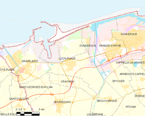
Gravelines (Gravelines)

- commune in Nord, France
- Country:

- Postal Code: 59820
- Coordinates: 50° 59' 11" N, 2° 7' 39" E


- GPS tracks (wikiloc): [Link]
- Area: 22.66 sq km
- Population: 11586
- Web site: http://www.ville-gravelines.fr/
- Wikipedia en: wiki(en)
- Wikipedia: wiki(fr)
- Wikidata storage: Wikidata: Q323399
- Wikipedia Commons Gallery: [Link]
- Wikipedia Commons Category: [Link]
- Wikipedia Commons Maps Category: [Link]
- Freebase ID: [/m/01z1tb]
- Freebase ID: [/m/01z1tb]
- GeoNames ID: Alt: [3014816]
- GeoNames ID: Alt: [3014816]
- SIREN number: [215902735]
- SIREN number: [215902735]
- BnF ID: [15266847r]
- BnF ID: [15266847r]
- VIAF ID: Alt: [135620783]
- VIAF ID: Alt: [135620783]
- OSM relation ID: [139316]
- OSM relation ID: [139316]
- GND ID: Alt: [4021900-8]
- GND ID: Alt: [4021900-8]
- archINFORM location ID: [16312]
- archINFORM location ID: [16312]
- Library of Congress authority ID: Alt: [n81122912]
- Library of Congress authority ID: Alt: [n81122912]
- PACTOLS thesaurus ID: [pcrtNrjZPt83tA]
- PACTOLS thesaurus ID: [pcrtNrjZPt83tA]
- MusicBrainz area ID: [0c9fe408-15d9-46e8-9991-2a01047171b1]
- MusicBrainz area ID: [0c9fe408-15d9-46e8-9991-2a01047171b1]
- SUDOC authorities ID: [067105033]
- SUDOC authorities ID: [067105033]
- Encyclopædia Britannica Online ID: [place/Gravelines]
- Encyclopædia Britannica Online ID: [place/Gravelines]
- EMLO location ID: [5e6dde26-b433-4336-a6d7-f492805c1929]
- EMLO location ID: [5e6dde26-b433-4336-a6d7-f492805c1929]
- Twitter username: Alt: [_Gravelines]
- Twitter username: Alt: [_Gravelines]
- Chemins de mémoire ID: [gravelines-0]
- Chemins de mémoire ID: [gravelines-0]
- INSEE municipality code: 59273
- INSEE municipality code: 59273
Shares border with regions:


Grand-Fort-Philippe
- commune in Nord, France
- Country:
- Postal Code: 59153
- Coordinates: 50° 59' 52" N, 2° 6' 33" E
- GPS tracks (wikiloc): [Link]
- Area: 3.13 sq km
- Population: 5142

Loon-Plage
- commune in Nord, France
- Country:
- Postal Code: 59279
- Coordinates: 50° 59' 39" N, 2° 13' 11" E
- GPS tracks (wikiloc): [Link]
- Area: 35.67 sq km
- Population: 6225
- Web site: [Link]


Saint-Georges-sur-l'Aa
- commune in Nord, France
- Country:
- Postal Code: 59820
- Coordinates: 50° 58' 7" N, 2° 9' 49" E
- GPS tracks (wikiloc): [Link]
- Area: 8.13 sq km
- Population: 311
- Web site: [Link]

Saint-Folquin
- commune in Pas-de-Calais, France
- Country:
- Postal Code: 62370
- Coordinates: 50° 56' 47" N, 2° 7' 20" E
- GPS tracks (wikiloc): [Link]
- Area: 17.95 sq km
- Population: 2192
- Web site: [Link]


Oye-Plage
- commune in Pas-de-Calais, France
- Country:
- Postal Code: 62215
- Coordinates: 50° 58' 40" N, 2° 2' 39" E
- GPS tracks (wikiloc): [Link]
- Area: 33.86 sq km
- Population: 5346
- Web site: [Link]