Heidelberg (Heidelberg)
- city in Baden-Württemberg, Germany
Heidelberg, located in the Baden-Württemberg region of Germany, is not only famous for its historic university and picturesque old town but also offers a variety of hiking opportunities for all levels of experience. The surrounding Odenwald Forest and the landscape along the Neckar River provide numerous scenic trails.
Popular Hiking Trails in Heidelberg:
-
Philosophenweg (Philosopher's Way):
- Distance: Approximately 2 km (1.2 miles)
- Difficulty: Easy to moderate
- Description: This iconic trail offers stunning views of Heidelberg and the Neckar River. It follows the northern side of the river and has several viewpoints along the way. It is named after the philosophers who used to walk here.
-
Heidelberg Castle Trail:
- Distance: Varies, depending on the route taken
- Difficulty: Moderate
- Description: Starting from the old town, this trail leads to Heidelberg Castle, giving you a chance to explore the castle and its gardens. The path is well-marked, and the views from the castle are spectacular.
-
Odenwald Trails:
- There are several longer and more challenging hikes available in the nearby Odenwald Forest, known for its diverse wildlife and lush scenery. Trails can range from 10 km to over 20 km, leading you through forests, pastures, and small villages.
-
Neckar Valley Trail (Neckarsteig):
- Distance: 124 km in total, but you can hike shorter sections
- Difficulty: Varies
- Description: This long-distance trail runs along the Neckar River, passing through charming towns and beautiful landscapes. Parts of the trail are quite accessible from Heidelberg and offer diverse hiking experiences.
Tips for Hiking in Heidelberg:
- Best Time to Go: Spring (April to June) and autumn (September to October) are ideal for hiking, with pleasant temperatures and beautiful foliage.
- What to Bring: Always carry a map or use a navigation app, wear comfortable hiking shoes, and bring water and snacks. Depending on the season, make sure to dress appropriately for changing weather conditions.
- Local Amenities: There are numerous cafes and rest spots along the trails, especially on more popular routes like the Philosophenweg.
- Safety: While most trails are well-marked, always be cautious of slippery or steep parts, and let someone know your hiking plans if you're venturing alone.
Hiking in Heidelberg not only offers physical challenges but also a chance to immerse yourself in stunning views and historic culture. Enjoy your hike!
- Country:

- Postal Code: 69001
- Local Dialing Code: 6202; 6221
- Licence Plate Code: HD
- Coordinates: 49° 24' 44" N, 8° 42' 36" E


- GPS tracks (wikiloc): [Link]
- AboveSeaLevel: 114 м m
- Area: 108.89 sq km
- Population: 159914
- Web site: https://www.heidelberg.de/
- Wikipedia en: wiki(en)
- Wikipedia: wiki(de)
- Wikidata storage: Wikidata: Q2966
- Wikipedia Commons Gallery: [Link]
- Wikipedia Commons Category: [Link]
- Wikipedia Commons Maps Category: [Link]
- Freebase ID: [/m/0cm5m]
- GeoNames ID: Alt: [2907911]
- VIAF ID: Alt: [144258029]
- OSM relation ID: [285864]
- GND ID: Alt: [4023996-2]
- archINFORM location ID: [145]
- Library of Congress authority ID: Alt: [n81096075]
- MusicBrainz area ID: [eee2e250-e74b-4216-896d-ec1980ea123c]
- Quora topic ID: [Heidelberg-Germany]
- Encyclopædia Britannica Online ID: [place/Heidelberg]
- Encyclopædia Universalis ID: [heidelberg]
- EMLO location ID: [9c3a2db5-866f-4132-9279-86f04bc5de5e]
- Facebook Places ID: [114466755232742]
- Great Russian Encyclopedia Online ID: [2347969]
- DMOZ ID: Alt: [Regional/Europe/Germany/States/Baden-Württemberg/Localities/Heidelberg/]
- National Library of Israel ID: [000986952]
- NUTS code: [DE125]
- Nomisma ID: [heidelberg]
- Klexikon article ID: [Heidelberg]
- NDL Auth ID: [00628943]
- Image Archive, Herder Institute: [Q2966]
- DDB ID: [MQESL2XUAHY2FEVOAN7T3MFB7ITEIAUR]
- German municipality key: 08221000
- US National Archives Identifier: 10044743
- German district key: 08221
Includes regions:
Liste der Stadtteile Heidelbergs
- Wikimedia list article
 Hiking in Liste der Stadtteile Heidelbergs
Heidelberg, a picturesque city in Germany, is not only known for its historic architecture and vibrant culture but also for its beautiful surrounding nature, which offers excellent hiking opportunities. The "Liste der Stadtteile Heidelbergs" refers to the various districts or boroughs of Heidelberg, each presenting unique landscapes and trails....


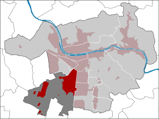
Emmertsgrund
- quarter of Heidelberg, Baden-Württemberg, Germany
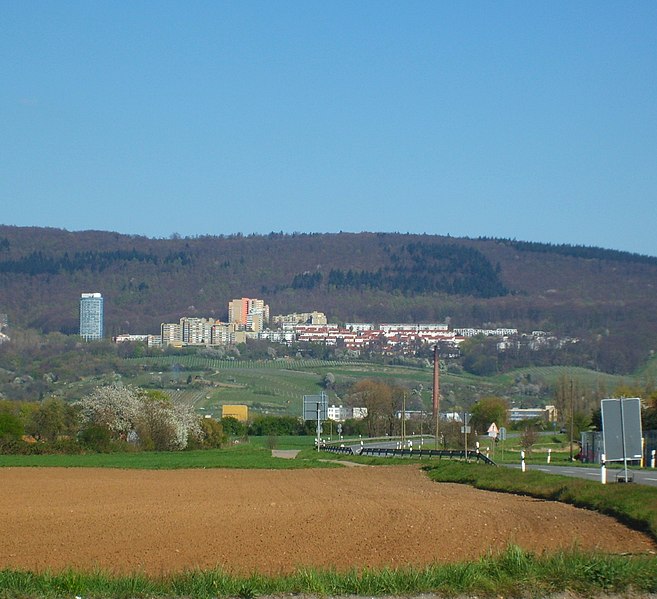
Emmertsgrund is a district located in the city of Heidelberg, Germany, known for its hills and natural landscapes. While Emmertsgrund itself is primarily a residential area, there are nearby hiking opportunities that provide beautiful views and outdoor experiences....
- Country:

- Coordinates: 49° 22' 1" N, 8° 42' 15" E


- GPS tracks (wikiloc): [Link]
Heidelberg-Südstadt
- quarter of Heidelberg, Baden-Württemberg, Germany
Heidelberg-Südstadt is a charming neighborhood located in Heidelberg, Germany, well-known for its picturesque surroundings and proximity to nature. While the area is primarily urban, there are several opportunities for hiking and enjoying the outdoors nearby:...
- Country:

- Coordinates: 49° 23' 37" N, 8° 41' 9" E


- GPS tracks (wikiloc): [Link]
Handschuhsheim
- quarter of Heidelberg, Baden-Württemberg, Germany
Handschuhsheim is a charming district of Heidelberg, Germany, and is surrounded by beautiful landscapes that are perfect for hiking enthusiasts. Here are some highlights and tips for hiking in and around Handschuhsheim:...
- Country:

- Coordinates: 49° 25' 42" N, 8° 41' 0" E


- GPS tracks (wikiloc): [Link]

Heidelberger Altstadt
- quarter of Heidelberg, Baden-Württemberg, Germany
 Hiking in Heidelberger Altstadt
Heidelberger Altstadt, or Heidelberg's Old Town, is renowned for its picturesque landscapes, charming streets, and rich history. While it doesn't feature traditional hiking trails, there are several opportunities for walking and exploring the beautiful natural surroundings, combined with the historical elements of the area....
- Country:

- Coordinates: 49° 24' 39" N, 8° 42' 23" E


- GPS tracks (wikiloc): [Link]


Kirchheim
- quarter of Heidelberg, Baden-Württemberg, Germany
Heidelberg-Kirchheim is a picturesque area in Germany, situated near the famous city of Heidelberg. It offers a range of hiking opportunities that showcase beautiful landscapes, charming villages, and historical sites. Here are some highlights and tips for hiking in the area:...
- Country:

- Coordinates: 49° 22' 38" N, 8° 39' 56" E


- GPS tracks (wikiloc): [Link]
- AboveSeaLevel: 113 м m


Schlierbach
- quarter of Heidelberg, Baden-Württemberg, Germany
Schlierbach is a beautiful area in Heidelberg, Germany, known for its scenic countryside and lush landscapes, making it a great destination for hiking enthusiasts. Here’s what you can expect when hiking in and around Schlierbach:...
- Country:

- Coordinates: 49° 24' 55" N, 8° 45' 38" E


- GPS tracks (wikiloc): [Link]


Neuenheim
- quarter of Heidelberg, Baden-Württemberg, Germany
Neuenheim, a district of Heidelberg in Germany, offers some delightful hiking opportunities along the scenic Neckar River and into the surrounding hills. While the area isn’t as mountainous as some regions in Germany, it provides a lovely mix of natural beauty and cultural attractions....
- Country:

- Coordinates: 49° 25' 1" N, 8° 41' 31" E


- GPS tracks (wikiloc): [Link]

Ziegelhausen
- quarter of Heidelberg, Baden-Württemberg, Germany
Heidelberg-Ziegelhausen is a picturesque area located near Heidelberg, Germany, known for its beautiful landscapes, historic trails, and charming villages. Here are some highlights and tips for hiking in this region:...
- Country:

- Coordinates: 49° 25' 6" N, 8° 45' 24" E


- GPS tracks (wikiloc): [Link]


Pfaffengrund
- quarter of Heidelberg, Baden-Württemberg, Germany
Pfaffengrund is a district in the city of Heidelberg, Germany, known for its beautiful natural landscapes and proximity to hiking opportunities. While it may not be a hiking destination in the same sense as larger national parks, it does offer access to trails in the surrounding areas, including the Odenwald forest region, which is known for its scenic views, diverse flora, and fauna....
- Country:

- Coordinates: 49° 24' 8" N, 8° 38' 50" E


- GPS tracks (wikiloc): [Link]
Rohrbach
- quarter of Heidelberg, Baden-Württemberg, Germany
Rohrbach, a district of Heidelberg, is situated in a picturesque area that offers a variety of hiking opportunities. The region is characterized by its lush landscapes, rolling hills, and scenic views of the surrounding countryside, making it a great destination for hikers of all skill levels....
- Country:

- Coordinates: 49° 22' 48" N, 8° 41' 14" E


- GPS tracks (wikiloc): [Link]

Weststadt
- quarter of Heidelberg, Baden-Württemberg, Germany
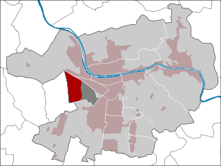
Heidelberg, specifically the Weststadt district, offers a charming blend of urban environment and easy access to wonderful hiking opportunities. While Weststadt itself is primarily residential and features lovely architecture and parks, it serves as a good starting point for exploring the surrounding natural areas....
- Country:

- Coordinates: 49° 24' 7" N, 8° 41' 5" E


- GPS tracks (wikiloc): [Link]
Wieblingen
- quarter of Heidelberg, Baden-Württemberg, Germany
Wieblingen is a district of the city of Heidelberg, Germany, and while it may not be as well-known for extensive hiking trails as some larger natural areas, there are still some beautiful walks and recreational opportunities in and around the area....
- Country:

- Coordinates: 49° 25' 43" N, 8° 38' 46" E


- GPS tracks (wikiloc): [Link]


Boxberg
- quarter of Heidelberg, Baden-Württemberg, Germany
Boxberg, a district of Heidelberg, is surrounded by beautiful landscapes, making it a great spot for hiking enthusiasts. Here are some highlights and useful information about hiking in Boxberg:...
- Country:

- Coordinates: 49° 22' 26" N, 8° 42' 12" E


- GPS tracks (wikiloc): [Link]


Bahnstadt
- quarter of Heidelberg, Baden-Württemberg, Germany
Bahnstadt, located in Heidelberg, Germany, is primarily known as an urban development area and may not have traditional hiking trails like more rural areas. However, it’s an interesting blend of architecture and nature, making it a good starting point for exploring nearby trails and parks....
- Country:

- Coordinates: 49° 24' 8" N, 8° 39' 58" E


- GPS tracks (wikiloc): [Link]
Bergheim
- quarter of Heidelberg, Baden-Württemberg, Germany
Heidelberg-Bergheim is a vibrant district in the city of Heidelberg, Germany, known for its mix of urban environment and natural beauty. While the district itself is primarily urban, it offers access to several hiking opportunities nearby....
- Country:

- Coordinates: 49° 24' 28" N, 8° 41' 3" E


- GPS tracks (wikiloc): [Link]
Shares border with regions:


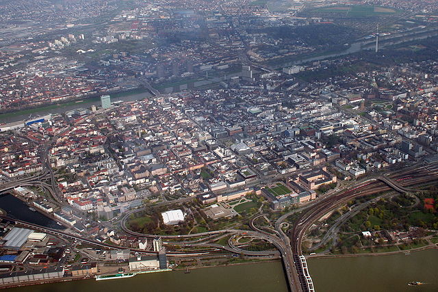
Mannheim
- city in Baden-Württemberg, Germany
Mannheim, located in southwestern Germany, is not typically known as a hiking destination compared to some of the more mountainous regions of the country. However, it does offer some pleasant walking and hiking opportunities, particularly along the Rhine and Neckar rivers. Here are some options for hiking in and around Mannheim:...
- Country:

- Postal Code: 68309; 68307; 68305; 68259; 68239; 68229; 68219; 68199; 68169; 68167; 68165; 68163; 68161; 68159
- Local Dialing Code: 0621
- Licence Plate Code: MA
- Coordinates: 49° 29' 1" N, 8° 27' 47" E


- GPS tracks (wikiloc): [Link]
- AboveSeaLevel: 97 м m
- Area: 144.97 sq km
- Population: 304781
- Web site: [Link]
