Herqueville (Herqueville)

- commune in Eure, France
- Country:

- Postal Code: 27430
- Coordinates: 49° 14' 40" N, 1° 15' 45" E


- GPS tracks (wikiloc): [Link]
- Area: 3.76 sq km
- Population: 144
- Wikipedia en: wiki(en)
- Wikipedia: wiki(fr)
- Wikidata storage: Wikidata: Q258225
- Wikipedia Commons Category: [Link]
- Freebase ID: [/m/03nqjw4]
- Freebase ID: [/m/03nqjw4]
- GeoNames ID: Alt: [6430436]
- GeoNames ID: Alt: [6430436]
- SIREN number: [212703300]
- SIREN number: [212703300]
- BnF ID: [152535668]
- BnF ID: [152535668]
- VIAF ID: Alt: [137355303]
- VIAF ID: Alt: [137355303]
- Library of Congress authority ID: Alt: [n93086784]
- Library of Congress authority ID: Alt: [n93086784]
- INSEE municipality code: 27330
- INSEE municipality code: 27330
Shares border with regions:


Connelles
- commune in Eure, France
- Country:
- Postal Code: 27430
- Coordinates: 49° 15' 22" N, 1° 16' 26" E
- GPS tracks (wikiloc): [Link]
- Area: 4.17 sq km
- Population: 196


Daubeuf-près-Vatteville
- commune in Eure, France
- Country:
- Postal Code: 27430
- Coordinates: 49° 16' 5" N, 1° 18' 10" E
- GPS tracks (wikiloc): [Link]
- Area: 11.35 sq km
- Population: 476


Muids
- commune in Eure, France
- Country:
- Postal Code: 27430
- Coordinates: 49° 13' 21" N, 1° 17' 26" E
- GPS tracks (wikiloc): [Link]
- Area: 15.22 sq km
- Population: 855


Porte-Joie
- former commune in Eure, France
- Country:
- Postal Code: 27430
- Coordinates: 49° 14' 44" N, 1° 15' 17" E
- GPS tracks (wikiloc): [Link]
- Area: 5.91 sq km
- Population: 109

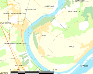
Andé
- commune in Eure, France
- Country:
- Postal Code: 27430
- Coordinates: 49° 13' 56" N, 1° 14' 28" E
- GPS tracks (wikiloc): [Link]
- Area: 5.31 sq km
- Population: 1253
- Web site: [Link]