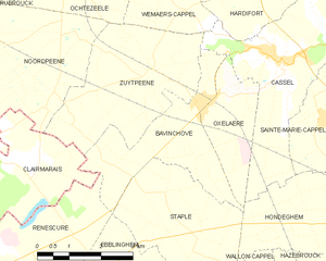
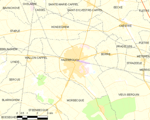
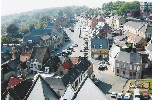
Hondeghem (Hondeghem)
- commune in Nord, France
- Country:

- Postal Code: 59190
- Coordinates: 50° 45' 24" N, 2° 31' 15" E


- GPS tracks (wikiloc): [Link]
- Area: 12.6 sq km
- Population: 989
- Web site: http://www.mairie-hondeghem.fr/
- Wikipedia en: wiki(en)
- Wikipedia: wiki(fr)
- Wikidata storage: Wikidata: Q532371
- Wikipedia Commons Category: [Link]
- Freebase ID: [/m/03qfjyp]
- Freebase ID: [/m/03qfjyp]
- GeoNames ID: Alt: [3013177]
- GeoNames ID: Alt: [3013177]
- SIREN number: [215903089]
- SIREN number: [215903089]
- BnF ID: [152668828]
- BnF ID: [152668828]
- VIAF ID: Alt: [125672333]
- VIAF ID: Alt: [125672333]
- PACTOLS thesaurus ID: [pcrtlmhfgVUTkD]
- PACTOLS thesaurus ID: [pcrtlmhfgVUTkD]
- EMLO location ID: [f8094ddf-b870-4e83-b9cc-cc9509182291]
- EMLO location ID: [f8094ddf-b870-4e83-b9cc-cc9509182291]
- INSEE municipality code: 59308
- INSEE municipality code: 59308
Shares border with regions:


Bavinchove
- commune in Nord, France
- Country:

- Postal Code: 59670
- Coordinates: 50° 47' 17" N, 2° 27' 25" E


- GPS tracks (wikiloc): [Link]
- Area: 8.31 sq km
- Population: 949
- Web site: [Link]


Hazebrouck
- commune in Nord, France
- Country:

- Postal Code: 59190
- Coordinates: 50° 43' 28" N, 2° 32' 18" E


- GPS tracks (wikiloc): [Link]
- AboveSeaLevel: 23 м m
- Area: 26.2 sq km
- Population: 21709
- Web site: [Link]


Cassel
- commune in Nord, France
- Country:

- Postal Code: 59670
- Coordinates: 50° 48' 0" N, 2° 29' 14" E


- GPS tracks (wikiloc): [Link]
- Area: 12.65 sq km
- Population: 2311
- Web site: [Link]


Saint-Sylvestre-Cappel
- commune in Nord, France
- Country:

- Postal Code: 59114
- Coordinates: 50° 46' 37" N, 2° 33' 15" E


- GPS tracks (wikiloc): [Link]
- Area: 8.14 sq km
- Population: 1166
- Web site: [Link]


Sainte-Marie-Cappel
- commune in Nord, France
- Country:

- Postal Code: 59670
- Coordinates: 50° 47' 4" N, 2° 30' 29" E


- GPS tracks (wikiloc): [Link]
- Area: 7.56 sq km
- Population: 870
- Web site: [Link]


Oxelaëre
- commune in Nord, France
- Country:

- Postal Code: 59670
- Coordinates: 50° 47' 19" N, 2° 28' 33" E


- GPS tracks (wikiloc): [Link]
- Area: 4.72 sq km
- Population: 535
- Web site: [Link]


Caëstre
- commune in Nord, France
- Country:

- Postal Code: 59190
- Coordinates: 50° 45' 30" N, 2° 36' 15" E


- GPS tracks (wikiloc): [Link]
- Area: 10.2 sq km
- Population: 1933
- Web site: [Link]


Wallon-Cappel
- commune in Nord, France
- Country:

- Postal Code: 59190
- Coordinates: 50° 43' 39" N, 2° 28' 23" E


- GPS tracks (wikiloc): [Link]
- Area: 5.44 sq km
- Population: 839
- Web site: [Link]


Staple
- commune in Nord, France
- Country:

- Postal Code: 59190
- Coordinates: 50° 44' 57" N, 2° 27' 16" E


- GPS tracks (wikiloc): [Link]
- Area: 9.97 sq km
- Population: 679
- Web site: [Link]
