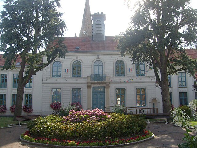
Hondschoote (Hondschoote)
- commune in Nord, France
- Country:

- Postal Code: 59122
- Coordinates: 50° 58' 46" N, 2° 35' 7" E


- GPS tracks (wikiloc): [Link]
- Area: 23.66 sq km
- Population: 4096
- Web site: http://www.cc-flandre.fr/hondschoote/
- Wikipedia en: wiki(en)
- Wikipedia: wiki(fr)
- Wikidata storage: Wikidata: Q391344
- Wikipedia Commons Category: [Link]
- Freebase ID: [/m/091p19]
- Freebase ID: [/m/091p19]
- GeoNames ID: Alt: [3013174]
- GeoNames ID: Alt: [3013174]
- SIREN number: [215903097]
- SIREN number: [215903097]
- BnF ID: [15266883m]
- BnF ID: [15266883m]
- VIAF ID: Alt: [123347597]
- VIAF ID: Alt: [123347597]
- Library of Congress authority ID: Alt: [n2002042657]
- Library of Congress authority ID: Alt: [n2002042657]
- Global Anabaptist Mennonite Encyclopedia Online ID: [Hondschoote (Nord-Pas-de-Calais, France)]
- Global Anabaptist Mennonite Encyclopedia Online ID: [Hondschoote (Nord-Pas-de-Calais, France)]
- INSEE municipality code: 59309
- INSEE municipality code: 59309
Shares border with regions:

Killem
- commune in Nord, France
- Country:

- Postal Code: 59122
- Coordinates: 50° 57' 29" N, 2° 33' 44" E


- GPS tracks (wikiloc): [Link]
- Area: 11.99 sq km
- Population: 1052
- Web site: [Link]


Oost-Cappel
- commune in Nord, France
- Country:

- Postal Code: 59122
- Coordinates: 50° 55' 29" N, 2° 35' 51" E


- GPS tracks (wikiloc): [Link]
- Area: 3.99 sq km
- Population: 478


Warhem
- commune in Nord, France
- Country:

- Postal Code: 59380
- Coordinates: 50° 58' 34" N, 2° 29' 35" E


- GPS tracks (wikiloc): [Link]
- Area: 27.84 sq km
- Population: 2055
- Web site: [Link]


Les Moëres
- former commune in Nord, France
- Country:

- Postal Code: 59122
- Coordinates: 51° 0' 53" N, 2° 33' 2" E


- GPS tracks (wikiloc): [Link]
- Area: 19.46 sq km
- Population: 997
