Houetteville (Houetteville)

- commune in Eure, France
- Country:

- Postal Code: 27400
- Coordinates: 49° 7' 36" N, 1° 6' 36" E


- GPS tracks (wikiloc): [Link]
- Area: 6.85 sq km
- Population: 204
- Wikipedia en: wiki(en)
- Wikipedia: wiki(fr)
- Wikidata storage: Wikidata: Q1073258
- Wikipedia Commons Category: [Link]
- Freebase ID: [/m/03nqjzl]
- Freebase ID: [/m/03nqjzl]
- GeoNames ID: Alt: [6430443]
- GeoNames ID: Alt: [6430443]
- SIREN number: [212703425]
- SIREN number: [212703425]
- BnF ID: [152535788]
- BnF ID: [152535788]
- INSEE municipality code: 27342
- INSEE municipality code: 27342
Shares border with regions:
Canappeville
- commune in Eure, France
- Country:
- Postal Code: 27400
- Coordinates: 49° 9' 21" N, 1° 5' 55" E
- GPS tracks (wikiloc): [Link]
- Area: 10.37 sq km
- Population: 666

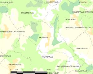
Brosville
- commune in Eure, France
- Country:
- Postal Code: 27930
- Coordinates: 49° 6' 31" N, 1° 6' 53" E
- GPS tracks (wikiloc): [Link]
- Area: 7.2 sq km
- Population: 629
Bérengeville-la-Campagne
- commune in Eure, France
- Country:
- Postal Code: 27110
- Coordinates: 49° 6' 53" N, 1° 4' 0" E
- GPS tracks (wikiloc): [Link]
- Area: 9.19 sq km
- Population: 309
- Web site: [Link]


Hondouville
- commune in Eure, France
- Country:
- Postal Code: 27400
- Coordinates: 49° 8' 21" N, 1° 7' 6" E
- GPS tracks (wikiloc): [Link]
- Area: 6.88 sq km
- Population: 800