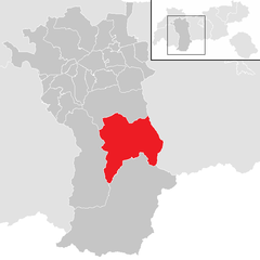
Imst District (Bezirk Imst)

- district of Austria
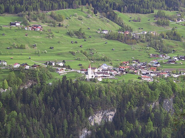
 Hiking in Imst District
The Imst District, located in the Tyrol region of Austria, is a fantastic destination for hiking enthusiasts. Known for its stunning Alpine landscapes, varied terrain, and charming villages, the area offers a wide range of hiking trails suitable for all skill levels, from beginner to advanced climbers.
Popular Hiking Areas and Trails:
-
Ötztal Valley: The trails in the Ötztal Valley lead to breathtaking views, alpine meadows, and glacial lakes. The area is known for its diverse flora and fauna.
-
Hochimst: This is a great starting point for various hiking routes. You can take the gondola up and enjoy trails that range from easy family walks to challenging mountain hikes.
-
Pitztal Glacier: Offering paths that lead to one of Austria's highest glaciers, the glacier hiking experience here is exceptional, allowing hikers to explore the unique glacial environment.
-
Zirbenweg Trail: This scenic trail is famous for its larch trees and offers a relatively easy hike with panoramic views of the surrounding mountains and valleys.
-
Alpine Pastures: Numerous trails lead to traditional alpine pastures where hikers can take a break at rustic huts and taste local Tyrolean cuisine, such as cheese and speck.
Best Times to Hike:
- Summer (June to September): This is the peak hiking season, with all trails accessible and the weather generally warm and stable.
- Autumn (September to October): Offers beautiful fall colors and fewer crowds, though some higher trails may start to close due to snow.
- Winter (December to March): While traditional hiking is limited, winter hiking and snowshoeing trails are available, with stunning snowy landscapes.
Preparedness:
- Gear: Proper hiking shoes, weather-appropriate clothing, layers for changing conditions, and a reliable backpack are essential.
- Maps: Always carry a detailed map or have a GPS-enabled device to navigate the trails.
- Hydration & Snacks: Stay hydrated and pack energy-rich snacks, especially on longer hikes.
- Weather: Check the weather forecast before heading out as conditions can change rapidly in the mountains.
Safety Tips:
- Always inform someone of your hiking plans.
- Listen to your body and know your limits.
- If you’re planning a longer or more challenging hike, consider hiring a local guide who knows the area well.
In conclusion, the Imst District offers diverse hiking opportunities that cater to outdoor lovers. With its beautiful scenery and well-marked trails, it's an excellent choice for a hiking adventure in Austria.
- Country:

- Capital: Imst
- Licence Plate Code: IM
- Coordinates: 47° 6' 0" N, 10° 54' 0" E


- GPS tracks (wikiloc): [Link]
- AboveSeaLevel: 2627 м m
- Area: 1724.82 sq km
- Population: 58214
- Web site: http://www.tirol.gv.at/bh-Imst
- Wikipedia en: wiki(en)
- Wikipedia: wiki(de)
- Wikidata storage: Wikidata: Q665668
- Wikipedia Commons Category: [Link]
- Wikipedia Commons Maps Category: [Link]
- Freebase ID: [/m/06skkf]
- GeoNames ID: Alt: [2775306]
- BnF ID: [11974091d]
- VIAF ID: Alt: [242561056]
- GND ID: Alt: [4095944-2]
- archINFORM location ID: [14614]
Includes regions:


Imst
- municipality in Austria
Hiking in Imst
Imst, located in the Tyrol region of Austria, is a fantastic destination for hiking enthusiasts, offering a diverse range of trails suitable for all skill levels. The area is characterized by stunning mountain scenery, lush valleys, and a variety of flora and fauna....
- Country:
- Postal Code: 6460
- Local Dialing Code: 05412
- Licence Plate Code: IM
- Coordinates: 47° 14' 22" N, 10° 44' 17" E
- GPS tracks (wikiloc): [Link]
- AboveSeaLevel: 827 м m
- Area: 113.4 sq km
- Population: 10504
- Web site: [Link]

Imsterberg
- municipality in Austria
Hiking in Imsterberg
Imsterberg, located in the Tyrol region of Austria, is a fantastic destination for hiking enthusiasts. This picturesque village offers access to stunning landscapes, beautiful alpine meadows, and breathtaking views of the surrounding mountains. Here are some key points to consider when planning a hiking trip in Imsterberg:...
- Country:
- Postal Code: 6492
- Local Dialing Code: 05412
- Licence Plate Code: IM
- Coordinates: 47° 12' 20" N, 10° 41' 50" E
- GPS tracks (wikiloc): [Link]
- AboveSeaLevel: 879 м m
- Area: 10.84 sq km
- Population: 777
- Web site: [Link]

Längenfeld
- municipality in Austria
Hiking in Längenfeld
Längenfeld is a picturesque village located in the Ötztal Valley of Tyrol, Austria. It is an excellent destination for hikers and outdoor enthusiasts, offering a variety of trails that cater to different skill levels. Here are some key points about hiking in Längenfeld:...
- Country:
- Postal Code: 6444
- Local Dialing Code: 05253
- Licence Plate Code: IM
- Coordinates: 47° 4' 0" N, 10° 58' 0" E
- GPS tracks (wikiloc): [Link]
- AboveSeaLevel: 1179 м m
- Area: 195.8 sq km
- Population: 4611
- Web site: [Link]

Sölden
- municipality in Tyrol, Austria
Hiking in Sölden
Sölden, located in the Ötztal Valley of Tyrol, Austria, is a fantastic destination for hiking enthusiasts. It's known for its stunning alpine scenery, diverse trails, and a wide range of outdoor activities. Here’s what you can expect when hiking in Sölden:...
- Country:
- Postal Code: 6450
- Local Dialing Code: 05254
- Licence Plate Code: IM
- Coordinates: 46° 58' 0" N, 11° 0' 0" E
- GPS tracks (wikiloc): [Link]
- AboveSeaLevel: 1368 м m
- Area: 466.78 sq km
- Population: 3145
- Web site: [Link]


Sautens
- municipality in the Imst district, Austria
Hiking in Sautens
Sautens is a picturesque village in the Ötztal Valley of Tyrol, Austria, which offers a range of fantastic hiking opportunities with stunning views of the surrounding mountains and valleys. Here are some aspects to consider if you're thinking of hiking in Sautens:...
- Country:
- Postal Code: 6432
- Local Dialing Code: 05252
- Licence Plate Code: IM
- Coordinates: 47° 12' 30" N, 10° 51' 55" E
- GPS tracks (wikiloc): [Link]
- AboveSeaLevel: 812 м m
- Area: 11.61 sq km
- Population: 1601
- Web site: [Link]


Oetz
- municipality in Austria
Hiking in Oetz
Oetz, a picturesque village located in the Ötztal Valley of Tyrol, Austria, is a fantastic destination for hiking enthusiasts. Surrounded by stunning alpine scenery, it offers a wide range of trails suitable for hikers of all skill levels....
- Country:
- Postal Code: 6433
- Local Dialing Code: 05252
- Licence Plate Code: IM
- Coordinates: 47° 12' 0" N, 10° 54' 0" E
- GPS tracks (wikiloc): [Link]
- AboveSeaLevel: 812 м m
- Area: 29.2 sq km
- Population: 2402
- Web site: [Link]


Mieming
- municipality in Austria
Hiking in Mieming
Mieming is a beautiful region located in the Tyrol province of Austria, known for its stunning landscapes and excellent hiking opportunities. Nestled at the foot of the Alps, the area offers a mix of scenic trails that cater to various skill levels, from easy walks to challenging hikes....
- Country:
- Postal Code: 6414
- Local Dialing Code: 0 52 64
- Licence Plate Code: IM
- Coordinates: 47° 18' 0" N, 10° 59' 0" E
- GPS tracks (wikiloc): [Link]
- AboveSeaLevel: 864 м m
- Area: 50.39 sq km
- Population: 3698
- Web site: [Link]


Karres
- municipality in Austria
Hiking in Karres
Hiking in Karres, a quaint village in the Tyrol region of Austria, offers a blend of stunning natural landscapes and well-maintained trails. Nestled in the mountains, Karres is an ideal location for both novice and experienced hikers. Here are some highlights and tips for hiking in this beautiful area:...
- Country:
- Postal Code: 6462
- Local Dialing Code: 05412
- Licence Plate Code: IM
- Coordinates: 47° 13' 10" N, 10° 46' 30" E
- GPS tracks (wikiloc): [Link]
- AboveSeaLevel: 830 м m
- Area: 7.52 sq km
- Population: 609
- Web site: [Link]


Nassereith
- municipality in Austria
Hiking in Nassereith
Nassereith, located in Tyrol, Austria, is a charming village known for its stunning landscapes and hiking opportunities. It serves as a fantastic base for outdoor enthusiasts looking to explore the natural beauty of the region. Here are some highlights and tips for hiking in Nassereith:...
- Country:
- Postal Code: 6465
- Local Dialing Code: 05265
- Licence Plate Code: IM
- Coordinates: 47° 19' 0" N, 10° 50' 0" E
- GPS tracks (wikiloc): [Link]
- AboveSeaLevel: 838 м m
- Area: 72.4 sq km
- Population: 2119
- Web site: [Link]

Mils bei Imst
- municipality in Austria
Hiking in Mils bei Imst
Mils bei Imst is a charming village located in the scenic Tyrolean region of Austria, surrounded by beautiful mountains, lush forests, and stunning landscapes. Hiking in this area offers a variety of trails that cater to different skill levels and preferences. Here are some highlights for hiking in Mils bei Imst:...
- Country:
- Postal Code: 6493
- Local Dialing Code: 05418
- Licence Plate Code: IM
- Coordinates: 47° 12' 20" N, 10° 40' 25" E
- GPS tracks (wikiloc): [Link]
- AboveSeaLevel: 743 м m
- Area: 3.49 sq km
- Population: 559
- Web site: [Link]

Umhausen
- municipality in Austria
Hiking in Umhausen
Umhausen is a picturesque village located in the Ötztal Valley of Tyrol, Austria, known for its stunning landscapes, rich history, and outdoor activities, especially hiking. The area offers a wide range of hiking trails suitable for all levels, from leisurely walks to challenging mountain treks....
- Country:
- Postal Code: 6441
- Local Dialing Code: 05255
- Licence Plate Code: IM
- Coordinates: 47° 7' 0" N, 10° 55' 0" E
- GPS tracks (wikiloc): [Link]
- AboveSeaLevel: 1031 м m
- Area: 137.4 sq km
- Population: 3220
- Web site: [Link]


Arzl im Pitztal
- municipality in Austria
Hiking in Arzl im Pitztal
Arzl im Pitztal, located in the stunning Tyrolean Alps of Austria, is a fantastic destination for hiking enthusiasts. The region offers a diverse range of trails, from leisurely walks to more challenging mountain hikes, making it suitable for hikers of all levels....
- Country:
- Postal Code: 6471
- Local Dialing Code: 05412
- Licence Plate Code: IM
- Coordinates: 47° 12' 30" N, 10° 45' 45" E
- GPS tracks (wikiloc): [Link]
- AboveSeaLevel: 880 м m
- Area: 29.36 sq km
- Population: 3134
- Web site: [Link]

Stams
- municipality in Austria
Hiking in Stams
Stams, located in the Tyrol region of Austria, is a great starting point for hikers looking to explore the beautiful landscapes of the Alps. Here are some key highlights about hiking in and around Stams:...
- Country:
- Postal Code: 6422
- Local Dialing Code: 05263
- Licence Plate Code: IM
- Coordinates: 47° 16' 35" N, 10° 59' 0" E
- GPS tracks (wikiloc): [Link]
- AboveSeaLevel: 672 м m
- Area: 33.56 sq km
- Population: 1495
- Web site: [Link]


Mötz
- municipality in Austria
Hiking in Mötz
Mötz is a charming village located in the Tyrol region of Austria, known for its stunning alpine landscapes and a variety of hiking trails suitable for different skill levels. Here’s some information to help you make the most of your hiking experience in Mötz:...
- Country:
- Postal Code: 6423
- Local Dialing Code: 0 52 63
- Licence Plate Code: IM
- Coordinates: 47° 16' 50" N, 10° 57' 20" E
- GPS tracks (wikiloc): [Link]
- AboveSeaLevel: 654 м m
- Area: 5.86 sq km
- Population: 1219
- Web site: [Link]


Rietz
- municipality in Austria
Hiking in Rietz
Rietz, located in the Tyrol region of Austria, is a beautiful destination for hiking enthusiasts. Surrounded by stunning Alpine scenery, it offers a variety of hiking trails suitable for different skill levels, from beginners to more experienced hikers....
- Country:
- Postal Code: 6421
- Local Dialing Code: 05262
- Licence Plate Code: IM
- Coordinates: 47° 17' 5" N, 11° 1' 50" E
- GPS tracks (wikiloc): [Link]
- AboveSeaLevel: 685 м m
- Area: 19.57 sq km
- Population: 2313
- Web site: [Link]

Tarrenz
- municipality in Austria
Hiking in Tarrenz
Tarrenz is a picturesque village located in the Tyrol region of Austria, surrounded by stunning mountainous landscapes, making it an excellent destination for hiking enthusiasts. Here are some highlights of hiking in and around Tarrenz:...
- Country:
- Postal Code: 6464
- Local Dialing Code: 05412
- Licence Plate Code: IM
- Coordinates: 47° 15' 50" N, 10° 45' 45" E
- GPS tracks (wikiloc): [Link]
- AboveSeaLevel: 836 м m
- Area: 74.64 sq km
- Population: 2744
- Web site: [Link]
Karrösten
- municipality in Austria
Hiking in Karrösten
Karrösten is a lesser-known yet beautiful area nestled in the Austrian Alps, making it a hidden gem for hikers. The region is characterized by stunning mountain landscapes, lush forests, and picturesque alpine meadows. Here are some key points to consider if you're planning to hike in Karrösten:...
- Country:
- Postal Code: 6463
- Local Dialing Code: 05412
- Licence Plate Code: IM
- Coordinates: 47° 13' 0" N, 10° 46' 0" E
- GPS tracks (wikiloc): [Link]
- AboveSeaLevel: 918 м m
- Area: 7.91 sq km
- Population: 676
- Web site: [Link]
Obsteig
- municipality in Austria
Hiking in Obsteig
Obsteig is a charming village located in the Tyrol region of Austria, nestled in the picturesque Mieming Plateau. It's an excellent destination for hiking enthusiasts of all skill levels due to its stunning landscapes, diverse trails, and beautiful mountain views....
- Country:
- Postal Code: 6416
- Local Dialing Code: 05264
- Licence Plate Code: IM
- Coordinates: 47° 17' 55" N, 10° 55' 40" E
- GPS tracks (wikiloc): [Link]
- AboveSeaLevel: 991 м m
- Area: 34.66 sq km
- Population: 1316
- Web site: [Link]

Jerzens
- municipality in Austria
Hiking in Jerzens
Jerzens is a charming village located in the Pitztal Valley of Tyrol, Austria, and it offers a wealth of hiking opportunities for outdoor enthusiasts. Nestled in the heart of the Alps, it boasts stunning mountainous landscapes, diverse flora and fauna, and scenic trails suitable for all levels of hikers....
- Country:
- Postal Code: 6474
- Local Dialing Code: 05414
- Licence Plate Code: IM
- Coordinates: 47° 8' 0" N, 10° 43' 0" E
- GPS tracks (wikiloc): [Link]
- AboveSeaLevel: 1107 м m
- Area: 30.4 sq km
- Population: 975
- Web site: [Link]


Wenns
- municipality in Austria
Hiking in Wenns
Wenns is a picturesque village located in the Tyrolean region of Austria, close to the Ötztal Alps. It's a popular destination for outdoor enthusiasts, particularly hikers, due to its stunning landscapes, diverse trails, and the charm of the Alpine environment....
- Country:
- Postal Code: 6473
- Local Dialing Code: 05414
- Licence Plate Code: IM
- Coordinates: 47° 10' 0" N, 10° 43' 0" E
- GPS tracks (wikiloc): [Link]
- AboveSeaLevel: 962 м m
- Area: 29.6 sq km
- Population: 2044
- Web site: [Link]
Silz
- municipality in Austria
Hiking in Silz
Silz, located in the Tyrol region of Austria, is a charming village that offers a range of hiking opportunities amidst stunning alpine scenery. Here are some highlights and information regarding hiking in this area:...
- Country:
- Postal Code: 6424
- Local Dialing Code: 05263
- Licence Plate Code: IM
- Coordinates: 47° 15' 55" N, 10° 55' 50" E
- GPS tracks (wikiloc): [Link]
- AboveSeaLevel: 654 м m
- Area: 65.67 sq km
- Population: 2560
- Web site: [Link]


Roppen
- municipality in Austria
Hiking in Roppen
Roppen, located in the Tyrol region of Austria, is a charming village that offers a variety of hiking opportunities set against stunning alpine landscapes. The area is characterized by its lush valleys, rugged mountains, and clear streams, making it a fantastic destination for both casual hikers and those seeking more challenging treks....
- Country:
- Postal Code: 6426
- Local Dialing Code: 05417
- Licence Plate Code: IM
- Coordinates: 47° 13' 0" N, 10° 49' 12" E
- GPS tracks (wikiloc): [Link]
- AboveSeaLevel: 724 м m
- Area: 30.86 sq km
- Population: 1800
- Web site: [Link]


Haiming
- municipality in Austria
Hiking in Haiming
Haiming, located in the Ötztal Valley of Tyrol, Austria, is a fantastic destination for hiking enthusiasts. The region offers a scenic backdrop of majestic mountains, lush valleys, and clear streams, making it a perfect spot for both beginner and experienced hikers....
- Country:
- Local Dialing Code: 05266
- Licence Plate Code: IM
- Coordinates: 47° 15' 12" N, 10° 52' 53" E
- GPS tracks (wikiloc): [Link]
- AboveSeaLevel: 670 м m
- Area: 40.2 sq km
- Population: 4659
- Web site: [Link]


Sankt Leonhard im Pitztal
- municipality in Austria
Hiking in Sankt Leonhard im Pitztal
Sankt Leonhard im Pitztal is a wonderful destination for hiking enthusiasts, located in the Tyrol region of Austria. This area offers stunning alpine scenery, with a variety of trails suited for different skill levels, making it a great choice for both beginners and experienced hikers....
- Country:
- Postal Code: 6481
- Local Dialing Code: 05413
- Licence Plate Code: IM
- Coordinates: 47° 4' 0" N, 10° 50' 0" E
- GPS tracks (wikiloc): [Link]
- AboveSeaLevel: 1366 м m
- Area: 223.4 sq km
- Population: 1382
- Web site: [Link]
Shares border with regions:


Garmisch-Partenkirchen
- district of Bavaria, Germany
Hiking in Garmisch-Partenkirchen
Garmisch-Partenkirchen is a beautiful district located in Bavaria, Germany, and is renowned for its stunning alpine scenery and outdoor recreational activities, making it a popular destination for hikers. Here are some key points about hiking in this picturesque area:...
- Country:

- Capital: Garmisch-Partenkirchen
- Licence Plate Code: GAP
- Coordinates: 47° 34' 48" N, 11° 10' 12" E
- GPS tracks (wikiloc): [Link]
- AboveSeaLevel: 1296 м m
- Area: 1012.00 sq km
- Population: 78782
- Web site: [Link]