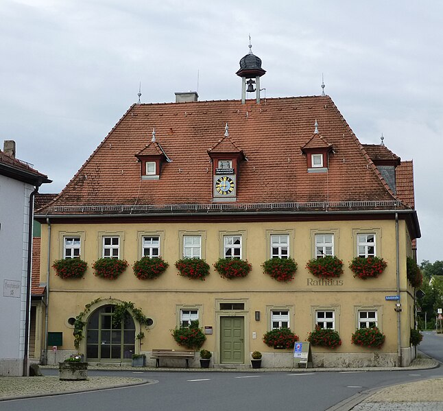
Iphofen (Iphofen)

- municipality of Germany
 Hiking in Iphofen
Iphofen is a charming town located in Bavaria, Germany, known for its scenic landscapes and rich history, making it a lovely destination for hiking enthusiasts. The region features a diverse array of hiking trails suitable for different skill levels, surrounded by beautiful vineyards, rolling hills, and historical sites.
Key Hiking Areas and Trails:
-
Frankenwein Trail: This trail weaves through the picturesque vineyards of the Franconian wine region. It offers stunning views of the countryside and is perfect for both leisurely strolls and more challenging hikes.
-
Iphofen Circular Trail: A well-marked loop that takes hikers around Iphofen, showcasing its medieval architecture and local vineyards. This trail is great for those looking to combine hiking with cultural exploration.
-
Wine and Nature Trail: A themed trail that provides insights into the local viticulture while letting you appreciate the natural beauty of the area. Along the path, you can often find information panels about the local flora and fauna, as well as wine production.
-
Burgundian Trail: This longer trail connects Iphofen to nearby towns and allows you to experience the Franconian countryside in-depth. It’s more suitable for experienced hikers looking for a full-day adventure.
Tips for Hiking in Iphofen:
- Best Time to Visit: Spring and autumn are the most pleasant seasons for hiking, with mild weather and beautiful foliage, especially in the vineyards.
- Gear: Wear sturdy hiking shoes and carry a hydration pack, especially during warmer months. A map or GPS device is also handy for navigating the trails.
- Local Cuisine: After your hike, don’t miss the opportunity to enjoy local Franconian cuisine and wines at one of the town's restaurants or wine taverns.
- Safety: Always inform someone of your hiking plans, and check the weather conditions before heading out.
Conclusion:
Iphofen offers a unique blend of scenic nature and cultural heritage, making it an excellent choice for hiking and exploration. Whether you are interested in leisurely walks or more challenging hikes, the area caters to all levels while providing stunning views and a taste of the local lifestyle. Enjoy your hiking adventure in this beautiful Bavarian town!
- Country:

- Postal Code: 97346
- Local Dialing Code: 09323
- Licence Plate Code: KT
- Coordinates: 49° 42' 0" N, 10° 16' 0" E


- GPS tracks (wikiloc): [Link]
- AboveSeaLevel: 250 м m
- Area: 78.01 sq km
- Population: 4584
- Web site: https://www.iphofen.de/
- Wikipedia en: wiki(en)
- Wikipedia: wiki(de)
- Wikidata storage: Wikidata: Q502741
- Wikipedia Commons Category: [Link]
- Freebase ID: [/m/0fds_w]
- GeoNames ID: Alt: [2895882]
- VIAF ID: Alt: [244068056]
- OSM relation ID: [282346]
- GND ID: Alt: [4027639-9]
- archINFORM location ID: [8507]
- Quora topic ID: [Iphofen]
- Bavarikon ID: [ODB_A00000365]
- German municipality key: 09675139
Shares border with regions:

Wiesenbronn
- municipality of Germany
Hiking in Wiesenbronn
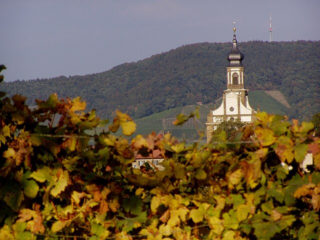
Wiesenbronn is a small village in the Lower Franconia region of Bavaria, Germany. While it may not be widely recognized as a hiking destination, it is surrounded by beautiful countryside and offers various opportunities for outdoor activities, including hiking. Here are some things to keep in mind when hiking in and around Wiesenbronn:...
- Country:
- Postal Code: 97355
- Local Dialing Code: 09325
- Licence Plate Code: KT
- Coordinates: 49° 45' 0" N, 10° 18' 0" E
- GPS tracks (wikiloc): [Link]
- AboveSeaLevel: 262 м m
- Area: 10.57 sq km
- Population: 848
- Web site: [Link]

Castell
- municipality of Germany
Hiking in Castell
Castell, located in Bavaria, Germany, is known for its beautiful landscapes and rich history, making it a great destination for hiking enthusiasts. Situated near the picturesque Main River and surrounded by rolling hills and vineyards, Castell offers a variety of trails that cater to different levels of hiking experience....
- Country:
- Postal Code: 97355
- Local Dialing Code: 09325
- Licence Plate Code: KT
- Coordinates: 49° 45' 0" N, 10° 20' 0" E
- GPS tracks (wikiloc): [Link]
- AboveSeaLevel: 317 м m
- Area: 22.93 sq km
- Population: 819
- Web site: [Link]