Irreville (Irreville)

- commune in Eure, France
- Country:

- Postal Code: 27930
- Coordinates: 49° 5' 44" N, 1° 12' 17" E


- GPS tracks (wikiloc): [Link]
- Area: 5.6 sq km
- Population: 476
- Wikipedia en: wiki(en)
- Wikipedia: wiki(fr)
- Wikidata storage: Wikidata: Q1074198
- Wikipedia Commons Category: [Link]
- Freebase ID: [/m/02x69yx]
- Freebase ID: [/m/02x69yx]
- GeoNames ID: Alt: [6430451]
- GeoNames ID: Alt: [6430451]
- SIREN number: [212703532]
- SIREN number: [212703532]
- BnF ID: [15253589x]
- BnF ID: [15253589x]
- INSEE municipality code: 27353
- INSEE municipality code: 27353
Shares border with regions:


Dardez
- commune in Eure, France
- Country:
- Postal Code: 27930
- Coordinates: 49° 4' 57" N, 1° 12' 31" E
- GPS tracks (wikiloc): [Link]
- Area: 2.82 sq km
- Population: 156


Cailly-sur-Eure
- commune in Eure, France
- Country:
- Postal Code: 27490
- Coordinates: 49° 6' 59" N, 1° 12' 45" E
- GPS tracks (wikiloc): [Link]
- Area: 3.33 sq km
- Population: 223

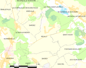
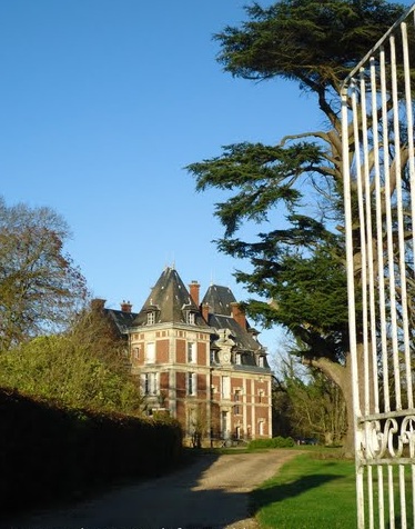
Reuilly
- commune in Eure, France
- Country:
- Postal Code: 27930
- Coordinates: 49° 4' 43" N, 1° 13' 24" E
- GPS tracks (wikiloc): [Link]
- Area: 9.73 sq km
- Population: 538
- Web site: [Link]

La Chapelle-du-Bois-des-Faulx
- commune in Eure, France
- Country:
- Postal Code: 27930
- Coordinates: 49° 6' 44" N, 1° 10' 0" E
- GPS tracks (wikiloc): [Link]
- Area: 4.37 sq km
- Population: 591

Le Boulay-Morin
- commune in Eure, France
- Country:
- Postal Code: 27930
- Coordinates: 49° 5' 6" N, 1° 10' 43" E
- GPS tracks (wikiloc): [Link]
- Area: 5.55 sq km
- Population: 767


Heudreville-sur-Eure
- commune in Eure, France
- Country:
- Postal Code: 27400
- Coordinates: 49° 8' 26" N, 1° 11' 19" E
- GPS tracks (wikiloc): [Link]
- Area: 14.15 sq km
- Population: 1042