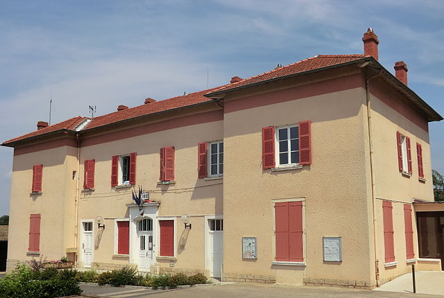
Jassans-Riottier (Jassans-Riottier)
- commune in Ain, France
- Country:

- Postal Code: 01480
- Coordinates: 45° 59' 8" N, 4° 45' 24" E


- GPS tracks (wikiloc): [Link]
- Area: 4.81 sq km
- Population: 6190
- Web site: http://www.jassansriottier.fr
- Wikipedia en: wiki(en)
- Wikipedia: wiki(fr)
- Wikidata storage: Wikidata: Q244528
- Wikipedia Commons Category: [Link]
- Wikipedia Commons Maps Category: [Link]
- Freebase ID: [/m/02wxrm1]
- Freebase ID: [/m/02wxrm1]
- GeoNames ID: Alt: [3012444]
- GeoNames ID: Alt: [3012444]
- SIREN number: [210101945]
- SIREN number: [210101945]
- BnF ID: [13119633r]
- BnF ID: [13119633r]
- VIAF ID: Alt: [303024957]
- VIAF ID: Alt: [303024957]
- WOEID: [595459]
- WOEID: [595459]
- INSEE municipality code: 01194
- INSEE municipality code: 01194
Shares border with regions:

Saint-Bernard
- commune in Ain, France
- Country:
- Postal Code: 01600
- Coordinates: 45° 56' 42" N, 4° 44' 14" E
- GPS tracks (wikiloc): [Link]
- Area: 3.15 sq km
- Population: 1436
- Web site: [Link]


Anse
- commune in Rhône, France
- Country:
- Postal Code: 69480
- Coordinates: 45° 56' 8" N, 4° 43' 10" E
- GPS tracks (wikiloc): [Link]
- Area: 15.23 sq km
- Population: 6925
- Web site: [Link]

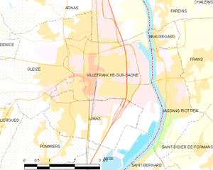
Villefranche-sur-Saône
- commune in Rhône, France
- Country:
- Postal Code: 69400
- Coordinates: 45° 59' 22" N, 4° 43' 11" E
- GPS tracks (wikiloc): [Link]
- AboveSeaLevel: 191 м m
- Area: 9.48 sq km
- Population: 36671
- Web site: [Link]

Beauregard
- commune in Ain, France
- Country:
- Postal Code: 01480
- Coordinates: 46° 0' 7" N, 4° 45' 5" E
- GPS tracks (wikiloc): [Link]
- Area: 0.94 sq km
- Population: 889
- Web site: [Link]


Frans
- commune in Ain, France
- Country:
- Postal Code: 01480
- Coordinates: 45° 59' 29" N, 4° 46' 26" E
- GPS tracks (wikiloc): [Link]
- Area: 7.98 sq km
- Population: 2265
- Web site: [Link]
Saint-Didier-de-Formans
- commune in Ain, France
- Country:
- Postal Code: 01600
- Coordinates: 45° 57' 23" N, 4° 46' 49" E
- GPS tracks (wikiloc): [Link]
- Area: 6.53 sq km
- Population: 1889
- Web site: [Link]