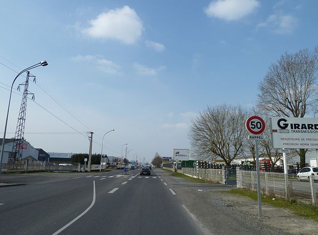
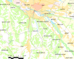
Jurançon (Jurançon)
- commune in Pyrénées-Atlantiques, France
- Country:

- Postal Code: 64110
- Coordinates: 43° 17' 14" N, 0° 23' 17" E


- GPS tracks (wikiloc): [Link]
- Area: 18.78 sq km
- Population: 7113
- Web site: http://www.jurancon.fr/
- Wikipedia en: wiki(en)
- Wikipedia: wiki(fr)
- Wikidata storage: Wikidata: Q199726
- Wikipedia Commons Category: [Link]
- Freebase ID: [/m/03y056d]
- Freebase ID: [/m/03y056d]
- GeoNames ID: Alt: [3012049]
- GeoNames ID: Alt: [3012049]
- SIREN number: [216402842]
- SIREN number: [216402842]
- BnF ID: [152701060]
- BnF ID: [152701060]
- VIAF ID: Alt: [156054657]
- VIAF ID: Alt: [156054657]
- Library of Congress authority ID: Alt: [n88638336]
- Library of Congress authority ID: Alt: [n88638336]
- WOEID: [595765]
- WOEID: [595765]
- INSEE municipality code: 64284
- INSEE municipality code: 64284
Shares border with regions:


Pau
- commune in Pyrénées-Atlantiques, France
- Country:

- Postal Code: 64000
- Coordinates: 43° 18' 3" N, 0° 22' 12" E


- GPS tracks (wikiloc): [Link]
- AboveSeaLevel: 205 м m
- Area: 31.51 sq km
- Population: 77215
- Web site: [Link]


Billère
- commune in Pyrénées-Atlantiques, France
- Country:

- Postal Code: 64140
- Coordinates: 43° 18' 0" N, 0° 24' 0" E


- GPS tracks (wikiloc): [Link]
- Area: 4.57 sq km
- Population: 13134
- Web site: [Link]


Laroin
- commune in Pyrénées-Atlantiques, France
- Country:

- Postal Code: 64110
- Coordinates: 43° 18' 16" N, 0° 26' 30" E


- GPS tracks (wikiloc): [Link]
- Area: 7.04 sq km
- Population: 1053


Lons
- commune in Pyrénées-Atlantiques, France
- Country:

- Postal Code: 64140
- Coordinates: 43° 18' 54" N, 0° 24' 39" E


- GPS tracks (wikiloc): [Link]
- Area: 11.53 sq km
- Population: 12718
- Web site: [Link]


Gelos
- commune in Pyrénées-Atlantiques, France
- Country:

- Postal Code: 64110
- Coordinates: 43° 17' 0" N, 0° 22' 16" E


- GPS tracks (wikiloc): [Link]
- Area: 11.03 sq km
- Population: 3525


Saint-Faust
- commune in Pyrénées-Atlantiques, France
- Country:

- Postal Code: 64110
- Coordinates: 43° 16' 0" N, 0° 27' 0" E


- GPS tracks (wikiloc): [Link]
- Area: 13.51 sq km
- Population: 757


Gan
- commune in Pyrénées-Atlantiques, France
- Country:

- Postal Code: 64290
- Coordinates: 43° 13' 43" N, 0° 23' 15" E


- GPS tracks (wikiloc): [Link]
- Area: 39.62 sq km
- Population: 5546
- Web site: [Link]
