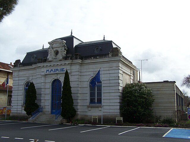
Lège-Cap-Ferret (Lège-Cap-Ferret)
- commune in Gironde, France
- Country:

- Postal Code: 33950
- Coordinates: 44° 47' 35" N, 1° 8' 47" E


- GPS tracks (wikiloc): [Link]
- AboveSeaLevel: 11 м m
- Area: 93.62 sq km
- Population: 8196
- Web site: http://www.ville-lege-capferret.fr
- Wikipedia en: wiki(en)
- Wikipedia: wiki(fr)
- Wikidata storage: Wikidata: Q201286
- Wikipedia Commons Category: [Link]
- Freebase ID: [/m/03mhcql]
- GeoNames ID: Alt: [6616555]
- SIREN number: [213302367]
- BnF ID: [15256288g]
- VIAF ID: Alt: [135871636]
- GND ID: Alt: [4552975-9]
- archINFORM location ID: [5388]
- Library of Congress authority ID: Alt: [nb2015012356]
- SUDOC authorities ID: [032204469]
- INSEE municipality code: 33236
Shares border with regions:


Arès
- commune in Gironde, France
- Country:

- Postal Code: 33740
- Coordinates: 44° 45' 54" N, 1° 8' 12" E


- GPS tracks (wikiloc): [Link]
- Area: 48.25 sq km
- Population: 6126
- Web site: [Link]


Le Porge
- commune in Gironde, France
- Country:

- Postal Code: 33680
- Coordinates: 44° 52' 22" N, 1° 5' 31" E


- GPS tracks (wikiloc): [Link]
- Area: 149.03 sq km
- Population: 2875
- Web site: [Link]
