Léouville (Léouville)

- commune in Loiret, France
- Country:

- Postal Code: 45480
- Coordinates: 48° 13' 24" N, 2° 5' 16" E


- GPS tracks (wikiloc): [Link]
- Area: 4.28 sq km
- Population: 79
- Wikipedia en: wiki(en)
- Wikipedia: wiki(fr)
- Wikidata storage: Wikidata: Q1423265
- Wikipedia Commons Category: [Link]
- Freebase ID: [/m/03nwjh5]
- GeoNames ID: Alt: [6434630]
- SIREN number: [214501819]
- INSEE municipality code: 45181
Shares border with regions:


Outarville
- commune in Loiret, France
- Country:
- Postal Code: 45480
- Coordinates: 48° 12' 41" N, 2° 1' 13" E
- GPS tracks (wikiloc): [Link]
- Area: 46.61 sq km
- Population: 1364
- Web site: [Link]


Charmont-en-Beauce
- commune in Loiret, France
- Country:
- Postal Code: 45480
- Coordinates: 48° 13' 55" N, 2° 6' 21" E
- GPS tracks (wikiloc): [Link]
- Area: 18.05 sq km
- Population: 376

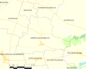
Greneville-en-Beauce
- commune in Loiret, France
- Country:
- Postal Code: 45480
- Coordinates: 48° 10' 54" N, 2° 6' 46" E
- GPS tracks (wikiloc): [Link]
- Area: 22.47 sq km
- Population: 677