Léry (Léry)

- commune in Eure, France
- Country:

- Postal Code: 27690
- Coordinates: 49° 17' 7" N, 1° 12' 24" E


- GPS tracks (wikiloc): [Link]
- Area: 14.51 sq km
- Population: 2049
- Web site: http://www.mairiedelery.fr/
- Wikipedia en: wiki(en)
- Wikipedia: wiki(fr)
- Wikidata storage: Wikidata: Q1074433
- Wikipedia Commons Category: [Link]
- Freebase ID: [/m/02x6b_7]
- Freebase ID: [/m/02x6b_7]
- GeoNames ID: Alt: [6430459]
- GeoNames ID: Alt: [6430459]
- SIREN number: [212703656]
- SIREN number: [212703656]
- INSEE municipality code: 27365
- INSEE municipality code: 27365
Shares border with regions:

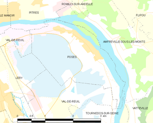
Poses
- commune in Eure, France
- Country:
- Postal Code: 27740
- Coordinates: 49° 18' 14" N, 1° 14' 40" E
- GPS tracks (wikiloc): [Link]
- Area: 7.2 sq km
- Population: 1172
- Web site: [Link]

Pont-de-l'Arche
- commune in Eure, France
- Country:
- Postal Code: 27340
- Coordinates: 49° 18' 10" N, 1° 9' 14" E
- GPS tracks (wikiloc): [Link]
- Area: 9.35 sq km
- Population: 4166
- Web site: [Link]
Les Damps
- commune in Eure, France
- Country:
- Postal Code: 27340
- Coordinates: 49° 18' 5" N, 1° 10' 20" E
- GPS tracks (wikiloc): [Link]
- Area: 4.74 sq km
- Population: 1332