L'Abergement-Sainte-Colombe (L'Abergement-Sainte-Colombe)

- commune in Saône-et-Loire, France
- Country:

- Postal Code: 71370
- Coordinates: 46° 45' 9" N, 5° 0' 25" E


- GPS tracks (wikiloc): [Link]
- AboveSeaLevel: 200 м m
- Area: 19.53 sq km
- Population: 1202
- Wikipedia en: wiki(en)
- Wikipedia: wiki(fr)
- Wikidata storage: Wikidata: Q1157530
- Wikipedia Commons Category: [Link]
- Wikipedia Commons Maps Category: [Link]
- Freebase ID: [/m/03qfw_w]
- Freebase ID: [/m/03qfw_w]
- GeoNames ID: Alt: [6617511]
- GeoNames ID: Alt: [6617511]
- SIREN number: [217100023]
- SIREN number: [217100023]
- BnF ID: [15272976v]
- BnF ID: [15272976v]
- INSEE municipality code: 71002
- INSEE municipality code: 71002
Shares border with regions:

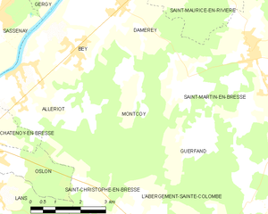
Montcoy
- commune in Saône-et-Loire, France
- Country:
- Postal Code: 71620
- Coordinates: 46° 48' 3" N, 4° 59' 52" E
- GPS tracks (wikiloc): [Link]
- Area: 9.06 sq km
- Population: 251


Saint-Martin-en-Bresse
- commune in Saône-et-Loire, France
- Country:
- Postal Code: 71620
- Coordinates: 46° 49' 1" N, 5° 3' 38" E
- GPS tracks (wikiloc): [Link]
- Area: 34.59 sq km
- Population: 1938


Guerfand
- commune in Saône-et-Loire, France
- Country:
- Postal Code: 71620
- Coordinates: 46° 47' 13" N, 5° 1' 51" E
- GPS tracks (wikiloc): [Link]
- Area: 6.44 sq km
- Population: 205

Lessard-en-Bresse
- commune in Saône-et-Loire, France
- Country:
- Postal Code: 71440
- Coordinates: 46° 44' 26" N, 5° 5' 37" E
- GPS tracks (wikiloc): [Link]
- Area: 8.2 sq km
- Population: 557


Saint-Christophe-en-Bresse
- commune in Saône-et-Loire, France
- Country:
- Postal Code: 71370
- Coordinates: 46° 45' 9" N, 4° 59' 18" E
- GPS tracks (wikiloc): [Link]
- Area: 20.39 sq km
- Population: 1104


Tronchy
- commune in Saône-et-Loire, France
- Country:
- Postal Code: 71440
- Coordinates: 46° 43' 39" N, 5° 4' 19" E
- GPS tracks (wikiloc): [Link]
- Area: 7.76 sq km
- Population: 255