L'Isle-sur-le-Doubs (L'Isle-sur-le-Doubs)

- commune in Doubs, France
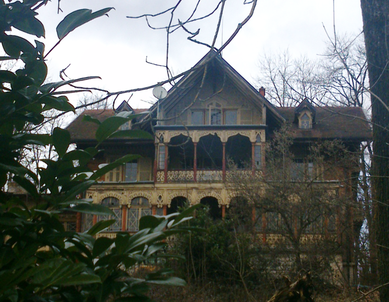
 Hiking in L'Isle-sur-le-Doubs
L'Isle-sur-le-Doubs, located in the Doubs department of France, offers a delightful hiking experience amidst beautiful natural scenery. Sitting along the Doubs River, this area features diverse landscapes, including forests, hills, and riversides, making it perfect for outdoor enthusiasts.
Hiking Trails
-
Local Trails: There are various marked trails in and around L'Isle-sur-le-Doubs that cater to different skill levels. Some trails may take you along the Doubs River, offering picturesque views and opportunities to spot local wildlife.
-
The TransDoubs Trail: This long-distance hiking route passes through the region, connecting L'Isle-sur-le-Doubs to other towns and featuring stunning vistas over the Jura mountains and the Doubs Valley.
-
Nature Walks: Shorter nature walks can be found within nearby forests and parks, allowing hikers to enjoy the connections between the woodland environment and the riverside.
Tips for Hiking in L'Isle-sur-le-Doubs
- Check Trail Conditions: Before heading out, it is advisable to check the trail conditions and any weather advisories to ensure a safe hike.
- Bring Sufficient Supplies: Make sure to pack enough water, snacks, a map or GPS, and a first aid kit.
- Dress Appropriately: Wear suitable hiking shoes and clothing for the weather conditions, and consider layers for temperature changes throughout the day.
- Respect Nature: Stay on marked trails to minimize your impact on the local flora and fauna.
Local Attractions
After a day of hiking, you can explore attractions in L'Isle-sur-le-Doubs, such as the charming town center, local eateries, and possibly visit nearby historical sites or other natural parks.
Conclusion
Whether you’re looking for a challenging trek or a leisurely stroll, L'Isle-sur-le-Doubs offers beautiful trails and stunning scenery, making it a great destination for hiking enthusiasts. Don't forget to take some time to enjoy the peaceful surroundings and the diverse wildlife.
- Country:

- Postal Code: 25250
- Coordinates: 47° 26' 52" N, 6° 35' 10" E


- GPS tracks (wikiloc): [Link]
- Area: 10.67 sq km
- Population: 3078
- Web site: http://islesurledoubs.fr/
- Wikipedia en: wiki(en)
- Wikipedia: wiki(fr)
- Wikidata storage: Wikidata: Q922699
- Wikipedia Commons Category: [Link]
- Freebase ID: [/m/03mhb49]
- Freebase ID: [/m/03mhb49]
- GeoNames ID: Alt: [6614270]
- GeoNames ID: Alt: [6614270]
- SIREN number: [212503155]
- SIREN number: [212503155]
- BnF ID: [15252541p]
- BnF ID: [15252541p]
- VIAF ID: Alt: [239650644]
- VIAF ID: Alt: [239650644]
- Library of Congress authority ID: Alt: [no2015122874]
- Library of Congress authority ID: Alt: [no2015122874]
- PACTOLS thesaurus ID: [pcrtPSEADdJNls]
- PACTOLS thesaurus ID: [pcrtPSEADdJNls]
- INSEE municipality code: 25315
- INSEE municipality code: 25315
Shares border with regions:


La Prétière
- commune in Doubs, France
Hiking in La Prétière
La Prétière is a beautiful area for outdoor enthusiasts and hikers. Located in the Vienne region of France, it offers a mix of scenic landscapes, lush green forests, and a variety of trails suitable for different skill levels. Here’s what you can expect when hiking in La Prétière:...
- Country:
- Postal Code: 25250
- Coordinates: 47° 26' 41" N, 6° 36' 34" E
- GPS tracks (wikiloc): [Link]
- Area: 2.71 sq km
- Population: 160


Anteuil
- commune in Doubs, France
Hiking in Anteuil
Anteuil is a small commune in the Doubs department in eastern France. While it might not be as widely recognized for hiking as some larger national parks or regions, it offers beautiful landscapes typical of the Jura foothills. Here are some things to consider when hiking in and around Anteuil:...
- Country:
- Postal Code: 25340
- Coordinates: 47° 23' 15" N, 6° 33' 39" E
- GPS tracks (wikiloc): [Link]
- Area: 24.29 sq km
- Population: 661

Appenans
- commune in Doubs, France
Hiking in Appenans
Hiking in the Apennines can be a wonderful experience, offering a range of landscapes, from lush green valleys to rugged peaks. The Apennine Mountain range stretches down the spine of Italy, running approximately 1,200 kilometers (750 miles) from the northern regions to the southern tip of the peninsula. Here’s what you should know about hiking in this beautiful area:...
- Country:
- Postal Code: 25250
- Coordinates: 47° 26' 34" N, 6° 33' 54" E
- GPS tracks (wikiloc): [Link]
- AboveSeaLevel: 290 м m
- Area: 4.07 sq km
- Population: 384


Blussans
- commune in Doubs, France
Hiking in Blussans
Blussans is a picturesque village located in the Jura region of France, known for its beautiful landscapes and outdoor activities, including hiking. Here are some key aspects of hiking in Blussans:...
- Country:
- Postal Code: 25250
- Coordinates: 47° 25' 39" N, 6° 36' 26" E
- GPS tracks (wikiloc): [Link]
- Area: 8.04 sq km
- Population: 196


Médière
- commune in Doubs, France
Hiking in Médière
Médière, located in the beautiful region of the French Alps, is known for its stunning landscapes and a variety of hiking trails suitable for different skill levels. Here are some key points you might find helpful when considering a hiking trip in Médière:...
- Country:
- Postal Code: 25250
- Coordinates: 47° 27' 24" N, 6° 35' 55" E
- GPS tracks (wikiloc): [Link]
- Area: 5.73 sq km
- Population: 302


Rang
- commune in Doubs, France
Hiking in Rang
Hiking in Rang, located in the Doubs department of France, offers a fantastic opportunity to explore the natural beauty of the Jura Mountains and the surrounding landscapes. The area is known for its stunning scenery, diverse wildlife, and numerous trails that cater to all levels of hikers....
- Country:
- Postal Code: 25250
- Coordinates: 47° 25' 35" N, 6° 33' 46" E
- GPS tracks (wikiloc): [Link]
- Area: 10.32 sq km
- Population: 420