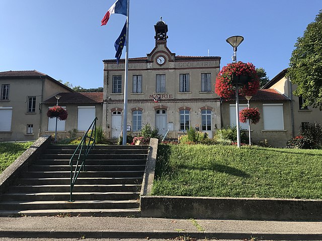
La Boisse (La Boisse)
- commune in Ain, France
- Country:

- Postal Code: 01120
- Coordinates: 45° 50' 32" N, 5° 2' 8" E


- GPS tracks (wikiloc): [Link]
- Area: 9.4 sq km
- Population: 2937
- Web site: http://www.ville-laboisse.fr
- Wikipedia en: wiki(en)
- Wikipedia: wiki(fr)
- Wikidata storage: Wikidata: Q212591
- Wikipedia Commons Category: [Link]
- Wikipedia Commons Maps Category: [Link]
- Freebase ID: [/m/07tt80]
- Freebase ID: [/m/07tt80]
- GeoNames ID: Alt: [3011008]
- GeoNames ID: Alt: [3011008]
- SIREN number: [210100491]
- SIREN number: [210100491]
- BnF ID: [12204105r]
- BnF ID: [12204105r]
- VIAF ID: Alt: [159536611]
- VIAF ID: Alt: [159536611]
- OSM relation ID: [149566]
- OSM relation ID: [149566]
- Library of Congress authority ID: Alt: [n87102835]
- Library of Congress authority ID: Alt: [n87102835]
- PACTOLS thesaurus ID: [pcrtNOoqVJx2Ez]
- PACTOLS thesaurus ID: [pcrtNOoqVJx2Ez]
- Pleiades ID: [167681]
- Pleiades ID: [167681]
- Trismegistos Geo ID: [23577]
- Trismegistos Geo ID: [23577]
- INSEE municipality code: 01049
- INSEE municipality code: 01049
Shares border with regions:

Beynost
- commune in Ain, France
- Country:

- Postal Code: 01700
- Coordinates: 45° 50' 25" N, 5° 0' 5" E


- GPS tracks (wikiloc): [Link]
- AboveSeaLevel: 174 м m
- Area: 10.64 sq km
- Population: 4529
- Web site: [Link]

Montluel
- commune in Ain, France
- Country:

- Postal Code: 01120
- Coordinates: 45° 51' 6" N, 5° 3' 23" E


- GPS tracks (wikiloc): [Link]
- Area: 40.11 sq km
- Population: 7032
- Web site: [Link]

Dagneux
- commune in Ain, France
- Country:

- Postal Code: 01120
- Coordinates: 45° 51' 6" N, 5° 4' 5" E


- GPS tracks (wikiloc): [Link]
- Area: 6.65 sq km
- Population: 4573
- Web site: [Link]

Niévroz
- commune in Ain, France
- Country:

- Postal Code: 01120
- Coordinates: 45° 49' 35" N, 5° 3' 50" E


- GPS tracks (wikiloc): [Link]
- Area: 10.46 sq km
- Population: 1535
- Web site: [Link]

Thil
- commune in Ain, France
- Country:

- Postal Code: 01700
- Coordinates: 45° 48' 51" N, 5° 1' 18" E


- GPS tracks (wikiloc): [Link]
- AboveSeaLevel: 178 м m
- Area: 5.15 sq km
- Population: 1057
- Web site: [Link]

Tramoyes
- commune in Ain, France
- Country:

- Postal Code: 01390
- Coordinates: 45° 52' 42" N, 4° 58' 5" E


- GPS tracks (wikiloc): [Link]
- Area: 12.93 sq km
- Population: 1674
- Web site: [Link]