
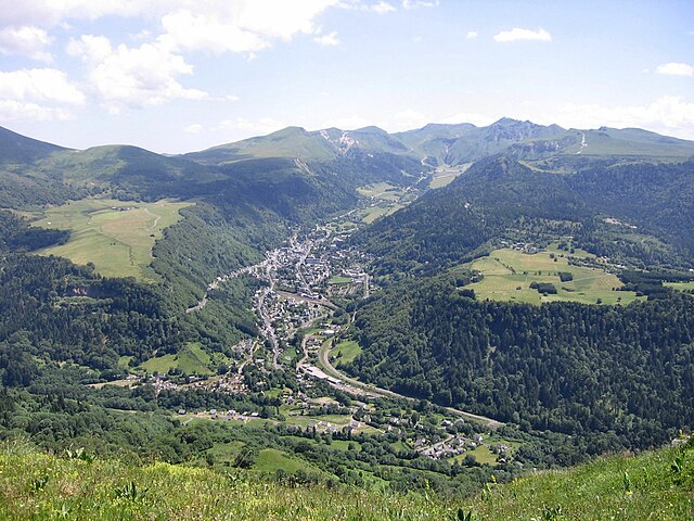
La Bourboule (La Bourboule)

- commune in Puy-de-Dôme, France
- Country:

- Postal Code: 63150
- Coordinates: 45° 35' 18" N, 2° 44' 21" E


- GPS tracks (wikiloc): [Link]
- Area: 12.74 sq km
- Population: 1786
- Web site: http://www.ville-labourboule.com
- Wikipedia en: wiki(en)
- Wikipedia: wiki(fr)
- Wikidata storage: Wikidata: Q539203
- Wikipedia Commons Category: [Link]
- Freebase ID: [/m/08l7dn]
- GeoNames ID: Alt: [3010882]
- SIREN number: [216300475]
- BnF ID: [15269397n]
- VIAF ID: Alt: [136238462]
- GND ID: Alt: [4643992-4]
- Library of Congress authority ID: Alt: [n2003015703]
- MusicBrainz area ID: [03853946-341d-4958-babc-099314e8482b]
- Great Russian Encyclopedia Online ID: [2127806]
- INSEE municipality code: 63047
Shares border with regions:
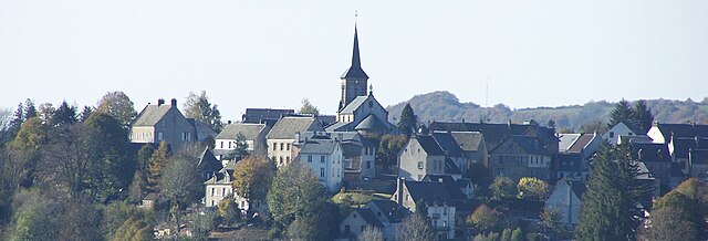
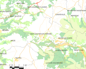
Saint-Sauves-d'Auvergne
- commune in Puy-de-Dôme, France
- Country:
- Postal Code: 63950
- Coordinates: 45° 36' 24" N, 2° 41' 16" E
- GPS tracks (wikiloc): [Link]
- Area: 49.86 sq km
- Population: 1123

Murat-le-Quaire
- commune in Puy-de-Dôme, France
- Country:
- Postal Code: 63150
- Coordinates: 45° 35' 52" N, 2° 44' 7" E
- GPS tracks (wikiloc): [Link]
- Area: 11.64 sq km
- Population: 481


La Tour-d'Auvergne
- commune in Puy-de-Dôme, France
- Country:
- Postal Code: 63680
- Coordinates: 45° 32' 2" N, 2° 41' 21" E
- GPS tracks (wikiloc): [Link]
- Area: 48.29 sq km
- Population: 648
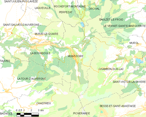
Mont-Dore
- commune in Puy-de-Dôme, France
- Country:
- Postal Code: 63240
- Coordinates: 45° 34' 35" N, 2° 48' 32" E
- GPS tracks (wikiloc): [Link]
- AboveSeaLevel: 1050 м m
- Area: 35.87 sq km
- Population: 1328
- Web site: [Link]