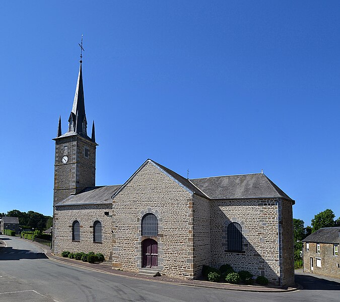
La Carneille (La Carneille)

- former commune in Orne, France
- Country:

- Postal Code: 61100
- Coordinates: 48° 46' 40" N, 0° 26' 45" E


- GPS tracks (wikiloc): [Link]
- Area: 15.91 sq km
- Population: 566
- Wikipedia en: wiki(en)
- Wikipedia: wiki(fr)
- Wikidata storage: Wikidata: Q127280
- Wikipedia Commons Category: [Link]
- Freebase ID: [/m/03qgqy3]
- Freebase ID: [/m/03qgqy3]
- GeoNames ID: Alt: [6456997]
- GeoNames ID: Alt: [6456997]
- BnF ID: [152680084]
- BnF ID: [152680084]
- INSEE municipality code: 61073
- INSEE municipality code: 61073
Shares border with regions:

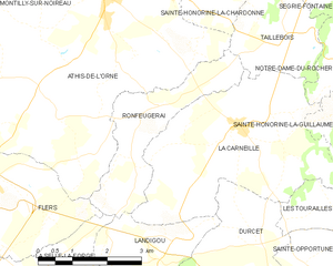
Ronfeugerai
- former commune in Orne, France
- Country:
- Postal Code: 61100
- Coordinates: 48° 46' 52" N, 0° 28' 35" E
- GPS tracks (wikiloc): [Link]
- Area: 6.57 sq km
- Population: 367


Sainte-Honorine-la-Guillaume
- commune in Orne, France
- Country:
- Postal Code: 61210
- Coordinates: 48° 46' 51" N, 0° 22' 45" E
- GPS tracks (wikiloc): [Link]
- Area: 14.87 sq km
- Population: 343


Taillebois
- former commune in Orne, France
- Country:
- Postal Code: 61100
- Coordinates: 48° 48' 6" N, 0° 26' 4" E
- GPS tracks (wikiloc): [Link]
- Area: 5.51 sq km
- Population: 139

Landigou
- commune in Orne, France
- Country:
- Postal Code: 61100
- Coordinates: 48° 44' 46" N, 0° 28' 17" E
- GPS tracks (wikiloc): [Link]
- Area: 5.36 sq km
- Population: 422


Notre-Dame-du-Rocher
- former commune in Orne, France
- Country:
- Postal Code: 61100
- Coordinates: 48° 47' 43" N, 0° 24' 23" E
- GPS tracks (wikiloc): [Link]
- Area: 3.43 sq km
- Population: 61


Durcet
- commune in Orne, France
- Country:
- Postal Code: 61100
- Coordinates: 48° 44' 49" N, 0° 26' 9" E
- GPS tracks (wikiloc): [Link]
- Area: 9.54 sq km
- Population: 300
- Web site: [Link]


Les Tourailles
- former commune in Orne, France
- Country:
- Postal Code: 61100
- Coordinates: 48° 45' 21" N, 0° 24' 4" E
- GPS tracks (wikiloc): [Link]
- Area: 2.46 sq km
- Population: 69