La Chapelle-Montabourlet (La Chapelle-Montabourlet)

- commune in Dordogne, France
- Country:

- Postal Code: 24320
- Coordinates: 45° 23' 36" N, 0° 27' 48" E


- GPS tracks (wikiloc): [Link]
- Area: 5.77 sq km
- Population: 68
- Wikipedia en: wiki(en)
- Wikipedia: wiki(fr)
- Wikidata storage: Wikidata: Q1070105
- Wikipedia Commons Category: [Link]
- Freebase ID: [/m/03mg5hz]
- Freebase ID: [/m/03mg5hz]
- GeoNames ID: Alt: [3010307]
- GeoNames ID: Alt: [3010307]
- SIREN number: [212401103]
- SIREN number: [212401103]
- BnF ID: [152517608]
- BnF ID: [152517608]
- INSEE municipality code: 24110
- INSEE municipality code: 24110
Shares border with regions:

Cercles
- former commune in Dordogne, France
- Country:
- Postal Code: 24320
- Coordinates: 45° 21' 51" N, 0° 27' 42" E
- GPS tracks (wikiloc): [Link]
- Area: 15.07 sq km
- Population: 199

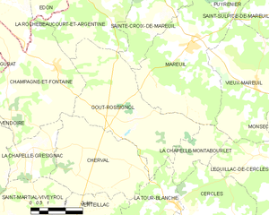
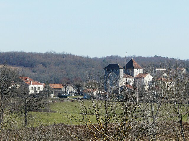
Gout-Rossignol
- commune in Dordogne, France
- Country:
- Postal Code: 24320
- Coordinates: 45° 24' 48" N, 0° 23' 3" E
- GPS tracks (wikiloc): [Link]
- AboveSeaLevel: 128 м m
- Area: 24.91 sq km
- Population: 384


Mareuil
- former commune in Dordogne, France
- Country:
- Postal Code: 24340
- Coordinates: 45° 27' 2" N, 0° 27' 8" E
- GPS tracks (wikiloc): [Link]
- AboveSeaLevel: 124 м m
- Area: 25.13 sq km
- Population: 1042
- Web site: [Link]


Léguillac-de-Cercles
- former commune in Dordogne, France
- Country:
- Postal Code: 24340
- Coordinates: 45° 23' 31" N, 0° 30' 52" E
- GPS tracks (wikiloc): [Link]
- AboveSeaLevel: 210 м m
- Area: 21.47 sq km
- Population: 300