La Chapelle-Réanville (La Chapelle-Réanville)

- former commune in Eure, France
- Country:

- Postal Code: 27950
- Coordinates: 49° 5' 43" N, 1° 22' 38" E


- GPS tracks (wikiloc): [Link]
- Area: 8.07 sq km
- Population: 1117
- Wikipedia en: wiki(en)
- Wikipedia: wiki(fr)
- Wikidata storage: Wikidata: Q368751
- Wikipedia Commons Category: [Link]
- Freebase ID: [/m/03nqg_b]
- Freebase ID: [/m/03nqg_b]
- GeoNames ID: Alt: [3010285]
- GeoNames ID: Alt: [3010285]
- BnF ID: [15253389c]
- BnF ID: [15253389c]
- INSEE municipality code: 27150
- INSEE municipality code: 27150
Shares border with regions:
Mercey
- commune in Eure, France
- Country:
- Postal Code: 27950
- Coordinates: 49° 4' 48" N, 1° 23' 35" E
- GPS tracks (wikiloc): [Link]
- Area: 3.5 sq km
- Population: 49

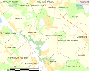
Houlbec-Cocherel
- commune in Eure, France
- Country:
- Postal Code: 27120
- Coordinates: 49° 4' 26" N, 1° 21' 50" E
- GPS tracks (wikiloc): [Link]
- Area: 11.64 sq km
- Population: 1328
- Web site: [Link]