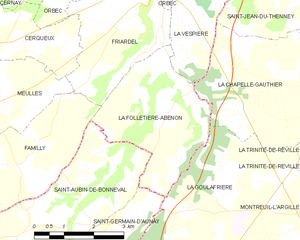
La Folletière-Abenon (La Folletière-Abenon)
- commune in Calvados, France
- Country:

- Postal Code: 14290
- Coordinates: 48° 58' 56" N, 0° 25' 26" E


- GPS tracks (wikiloc): [Link]
- Area: 10.75 sq km
- Population: 137
- Wikipedia en: wiki(en)
- Wikipedia: wiki(fr)
- Wikidata storage: Wikidata: Q864976
- Wikipedia Commons Category: [Link]
- Freebase ID: [/m/02x5rq]
- Freebase ID: [/m/02x5rq]
- GeoNames ID: Alt: [6615038]
- GeoNames ID: Alt: [6615038]
- SIREN number: [211402730]
- SIREN number: [211402730]
- BnF ID: [152476878]
- BnF ID: [152476878]
- INSEE municipality code: 14273
- INSEE municipality code: 14273
Shares border with regions:


La Vespière
- former commune in Calvados, France
- Country:

- Postal Code: 14290
- Coordinates: 49° 1' 7" N, 0° 24' 44" E


- GPS tracks (wikiloc): [Link]
- Area: 8.65 sq km
- Population: 977
La Goulafrière
- commune in Eure, France
- Country:

- Postal Code: 27390
- Coordinates: 48° 57' 0" N, 0° 26' 12" E


- GPS tracks (wikiloc): [Link]
- Area: 14.38 sq km
- Population: 165
Saint-Germain-d'Aunay
- commune in Orne, France
- Country:

- Postal Code: 61470
- Coordinates: 48° 55' 32" N, 0° 22' 46" E


- GPS tracks (wikiloc): [Link]
- Area: 8.51 sq km
- Population: 156
Saint-Aubin-de-Bonneval
- commune in Orne, France
- Country:

- Postal Code: 61470
- Coordinates: 48° 56' 27" N, 0° 22' 46" E


- GPS tracks (wikiloc): [Link]
- Area: 11.67 sq km
- Population: 143


Friardel
- former commune in Calvados, France
- Country:

- Postal Code: 14290
- Coordinates: 49° 0' 1" N, 0° 23' 19" E


- GPS tracks (wikiloc): [Link]
- Area: 9.39 sq km
- Population: 242


Familly
- former commune in Calvados, France
- Country:

- Postal Code: 14290
- Coordinates: 48° 58' 0" N, 0° 21' 16" E


- GPS tracks (wikiloc): [Link]
- Area: 10.71 sq km
- Population: 107


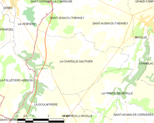
La Chapelle-Gauthier
- commune in Eure, France
- Country:

- Postal Code: 27270
- Coordinates: 48° 59' 10" N, 0° 27' 44" E


- GPS tracks (wikiloc): [Link]
- Area: 16.43 sq km
- Population: 409
