La Forêt-Auvray (La Forêt-Auvray)

- former commune in Orne, France
- Country:

- Postal Code: 61210
- Coordinates: 48° 48' 42" N, 0° 20' 32" E


- GPS tracks (wikiloc): [Link]
- Area: 10.96 sq km
- Population: 174
- Wikipedia en: wiki(en)
- Wikipedia: wiki(fr)
- Wikidata storage: Wikidata: Q1095104
- Wikipedia Commons Category: [Link]
- Freebase ID: [/m/03qgrc8]
- Freebase ID: [/m/03qgrc8]
- GeoNames ID: Alt: [6456284]
- GeoNames ID: Alt: [6456284]
- BnF ID: [15268106q]
- BnF ID: [15268106q]
- INSEE municipality code: 61174
- INSEE municipality code: 61174
Shares border with regions:


Sainte-Honorine-la-Guillaume
- commune in Orne, France
- Country:
- Postal Code: 61210
- Coordinates: 48° 46' 51" N, 0° 22' 45" E
- GPS tracks (wikiloc): [Link]
- Area: 14.87 sq km
- Population: 343


Saint-Aubert-sur-Orne
- former commune in Orne, France
- Country:
- Postal Code: 61210
- Coordinates: 48° 47' 22" N, 0° 19' 52" E
- GPS tracks (wikiloc): [Link]
- Area: 9.69 sq km
- Population: 109


Les Isles-Bardel
- commune in Calvados, France
- Country:
- Postal Code: 14690
- Coordinates: 48° 50' 43" N, 0° 20' 18" E
- GPS tracks (wikiloc): [Link]
- Area: 5.69 sq km
- Population: 67

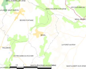
Bréel
- former commune in Orne, France
- Country:
- Postal Code: 61100
- Coordinates: 48° 48' 47" N, 0° 23' 25" E
- GPS tracks (wikiloc): [Link]
- Area: 3.71 sq km
- Population: 126


Ménil-Hermei
- commune in Orne, France
- Country:
- Postal Code: 61210
- Coordinates: 48° 49' 35" N, 0° 19' 34" E
- GPS tracks (wikiloc): [Link]
- Area: 6.61 sq km
- Population: 203


Saint-Philbert-sur-Orne
- commune in Orne, France
- Country:
- Postal Code: 61430
- Coordinates: 48° 50' 24" N, 0° 22' 44" E
- GPS tracks (wikiloc): [Link]
- Area: 5.97 sq km
- Population: 110