La Mesnière (La Mesnière)

- commune in Orne, France
- Country:

- Postal Code: 61560
- Coordinates: 48° 31' 26" N, 0° 25' 59" E


- GPS tracks (wikiloc): [Link]
- AboveSeaLevel: 160 м m
- Area: 12.26 sq km
- Population: 297
- Web site: http://www.lamesniere.com
- Wikipedia en: wiki(en)
- Wikipedia: wiki(fr)
- Wikidata storage: Wikidata: Q919384
- Wikipedia Commons Category: [Link]
- Freebase ID: [/m/03qgqhk]
- Freebase ID: [/m/03qgqhk]
- GeoNames ID: Alt: [6617254]
- GeoNames ID: Alt: [6617254]
- SIREN number: [216102772]
- SIREN number: [216102772]
- INSEE municipality code: 61277
- INSEE municipality code: 61277
Shares border with regions:
Courgeoût
- commune in Orne, France
- Country:
- Postal Code: 61560
- Coordinates: 48° 30' 35" N, 0° 29' 23" E
- GPS tracks (wikiloc): [Link]
- Area: 17.82 sq km
- Population: 446


Buré
- commune in Orne, France
- Country:
- Postal Code: 61170
- Coordinates: 48° 31' 3" N, 0° 24' 20" E
- GPS tracks (wikiloc): [Link]
- Area: 5.65 sq km
- Population: 110


Bazoches-sur-Hoëne
- commune in Orne, France
- Country:
- Postal Code: 61560
- Coordinates: 48° 33' 7" N, 0° 28' 17" E
- GPS tracks (wikiloc): [Link]
- Area: 21.44 sq km
- Population: 879
- Web site: [Link]

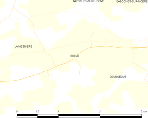
Boëcé
- commune in Orne, France
- Country:
- Postal Code: 61560
- Coordinates: 48° 30' 47" N, 0° 26' 59" E
- GPS tracks (wikiloc): [Link]
- Area: 2.41 sq km
- Population: 117


Coulonges-sur-Sarthe
- commune in Orne, France
- Country:
- Postal Code: 61170
- Coordinates: 48° 31' 54" N, 0° 23' 59" E
- GPS tracks (wikiloc): [Link]
- Area: 9.65 sq km
- Population: 535

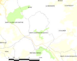
Saint-Quentin-de-Blavou
- commune in Orne, France
- Country:
- Postal Code: 61360
- Coordinates: 48° 28' 13" N, 0° 25' 1" E
- GPS tracks (wikiloc): [Link]
- Area: 6.46 sq km
- Population: 73


Bures
- commune in Orne, France
- Country:
- Postal Code: 61170
- Coordinates: 48° 33' 48" N, 0° 24' 5" E
- GPS tracks (wikiloc): [Link]
- Area: 9.64 sq km
- Population: 167

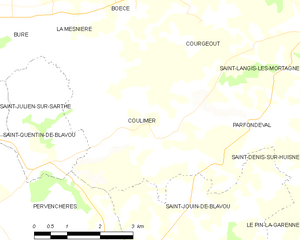
Coulimer
- commune in Orne, France
- Country:
- Postal Code: 61360
- Coordinates: 48° 28' 31" N, 0° 28' 1" E
- GPS tracks (wikiloc): [Link]
- Area: 17.19 sq km
- Population: 299