La Meyze (La Meyze)

- commune in Haute-Vienne, France
- Country:

- Postal Code: 87800
- Coordinates: 45° 37' 1" N, 1° 12' 51" E


- GPS tracks (wikiloc): [Link]
- Area: 28.11 sq km
- Population: 816
- Wikipedia en: wiki(en)
- Wikipedia: wiki(fr)
- Wikidata storage: Wikidata: Q179285
- Wikipedia Commons Category: [Link]
- Freebase ID: [/m/03nv1f8]
- GeoNames ID: Alt: [6457171]
- SIREN number: [218709608]
- BnF ID: [152788196]
- archINFORM location ID: [5219]
- INSEE municipality code: 87096
Shares border with regions:

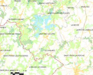
Ladignac-le-Long
- commune in Haute-Vienne, France
- Country:
- Postal Code: 87500
- Coordinates: 45° 34' 57" N, 1° 6' 50" E
- GPS tracks (wikiloc): [Link]
- Area: 47.21 sq km
- Population: 1159


Nexon
- commune in Haute-Vienne, France
- Country:
- Postal Code: 87800
- Coordinates: 45° 40' 42" N, 1° 11' 14" E
- GPS tracks (wikiloc): [Link]
- Area: 40.79 sq km
- Population: 2568
- Web site: [Link]

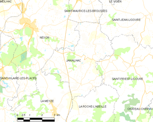
Janailhac
- commune in Haute-Vienne, France
- Country:
- Postal Code: 87800
- Coordinates: 45° 38' 13" N, 1° 14' 28" E
- GPS tracks (wikiloc): [Link]
- Area: 18.73 sq km
- Population: 535
- Web site: [Link]


La Roche-l'Abeille
- commune in Haute-Vienne, France
- Country:
- Postal Code: 87800
- Coordinates: 45° 35' 46" N, 1° 14' 29" E
- GPS tracks (wikiloc): [Link]
- Area: 36.56 sq km
- Population: 619
- Web site: [Link]

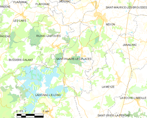
Saint-Hilaire-les-Places
- commune in Haute-Vienne, France
- Country:
- Postal Code: 87800
- Coordinates: 45° 38' 42" N, 1° 9' 33" E
- GPS tracks (wikiloc): [Link]
- Area: 23.06 sq km
- Population: 894
- Web site: [Link]


Saint-Yrieix-la-Perche
- commune in Haute-Vienne, France
- Country:
- Postal Code: 87500
- Coordinates: 45° 30' 52" N, 1° 12' 12" E
- GPS tracks (wikiloc): [Link]
- Area: 100.98 sq km
- Population: 6813
- Web site: [Link]