La Plaine (La Plaine)

- commune in Maine-et-Loire, France
- Country:

- Postal Code: 49360
- Coordinates: 47° 4' 5" N, 0° 38' 6" E


- GPS tracks (wikiloc): [Link]
- Area: 22.16 sq km
- Population: 1045
- Wikipedia en: wiki(en)
- Wikipedia: wiki(fr)
- Wikidata storage: Wikidata: Q1650051
- Wikipedia Commons Category: [Link]
- Freebase ID: [/m/03qf5xx]
- GeoNames ID: Alt: [6456078]
- SIREN number: [214902405]
- BnF ID: [152618404]
- Library of Congress authority ID: Alt: [n96032211]
- MusicBrainz area ID: [af6a028f-c46d-437b-8738-c2fb009464aa]
- INSEE municipality code: 49240
Shares border with regions:


Yzernay
- commune in Maine-et-Loire, France
- Country:
- Postal Code: 49360
- Coordinates: 47° 1' 18" N, 0° 42' 10" E
- GPS tracks (wikiloc): [Link]
- Area: 40.66 sq km
- Population: 1850


Somloire
- commune in Maine-et-Loire, France
- Country:
- Postal Code: 49360
- Coordinates: 47° 2' 1" N, 0° 36' 23" E
- GPS tracks (wikiloc): [Link]
- Area: 31.83 sq km
- Population: 905


Coron
- commune in Maine-et-Loire, France
- Country:
- Postal Code: 49690
- Coordinates: 47° 7' 39" N, 0° 38' 39" E
- GPS tracks (wikiloc): [Link]
- AboveSeaLevel: 131 м m
- Area: 31.49 sq km
- Population: 1606

Chanteloup-les-Bois
- commune in Maine-et-Loire, France
- Country:
- Postal Code: 49340
- Coordinates: 47° 5' 41" N, 0° 41' 8" E
- GPS tracks (wikiloc): [Link]
- Area: 27.47 sq km
- Population: 720

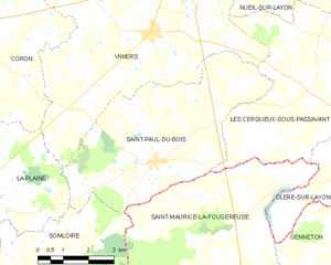
Saint-Paul-du-Bois
- commune in Maine-et-Loire, France
- Country:
- Postal Code: 49310
- Coordinates: 47° 4' 51" N, 0° 32' 41" E
- GPS tracks (wikiloc): [Link]
- Area: 26.58 sq km
- Population: 602
- Web site: [Link]