La Villette (La Villette)

- commune in Calvados, France
- Country:

- Postal Code: 14570
- Coordinates: 48° 54' 43" N, 0° 32' 36" E


- GPS tracks (wikiloc): [Link]
- Area: 9.74 sq km
- Population: 220
- Wikipedia en: wiki(en)
- Wikipedia: wiki(fr)
- Wikidata storage: Wikidata: Q636251
- Wikipedia Commons Category: [Link]
- Freebase ID: [/m/04295p]
- Freebase ID: [/m/04295p]
- GeoNames ID: Alt: [6455602]
- GeoNames ID: Alt: [6455602]
- SIREN number: [211407564]
- SIREN number: [211407564]
- BnF ID: [152481634]
- BnF ID: [152481634]
- INSEE municipality code: 14756
- INSEE municipality code: 14756
Shares border with regions:

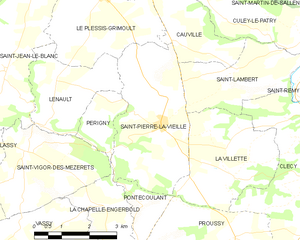
Saint-Pierre-la-Vieille
- former commune in Calvados, France
- Country:
- Postal Code: 14770
- Coordinates: 48° 55' 8" N, 0° 34' 35" E
- GPS tracks (wikiloc): [Link]
- Area: 12.43 sq km
- Population: 344


Saint-Lambert
- commune in Calvados, France
- Country:
- Postal Code: 14570
- Coordinates: 48° 56' 13" N, 0° 32' 55" E
- GPS tracks (wikiloc): [Link]
- Area: 7.45 sq km
- Population: 282


Clécy
- commune in Calvados, France
- Country:
- Postal Code: 14570
- Coordinates: 48° 54' 58" N, 0° 28' 59" E
- GPS tracks (wikiloc): [Link]
- Area: 24.63 sq km
- Population: 1243
- Web site: [Link]


Proussy
- former commune in Calvados, France
- Country:
- Postal Code: 14110
- Coordinates: 48° 52' 54" N, 0° 32' 15" E
- GPS tracks (wikiloc): [Link]
- AboveSeaLevel: 250 м m
- Area: 12.64 sq km
- Population: 401